Showing posts with label Vancouver Island. Show all posts

Sunday, August 21, 2022

Resurrection

Off-topic: I have another blog, Remembering Jellybean, where I have posted short stories, both fiction and biographical, childhood memories, poems, Mexican legends ... 

From the introduction: "I was born on a native reserve in Ontario, grew up on the west coast of Vancouver Island (as far west as you can go without running out of Canada), came of age in Mexico City. Between times, I lived in the Fraser Valley, Texas, Seattle, Oklahoma, Bella Coola on the BC north coast, and the Fraser River Delta, just south of Vancouver. For now, I'm "settled" in Campbell River, on Vancouver Island.

I have a boatload of stories to tell. These are some of them."

I had stopped posting to this blog some years back, I'm not sure why. Now I've woken it up again, with a couple of stories today. I'll keep adding to it from now on. Go take a look.

The Lizzie. Our school boat, 1950s.


Saturday, September 04, 2021

Forlorn hope

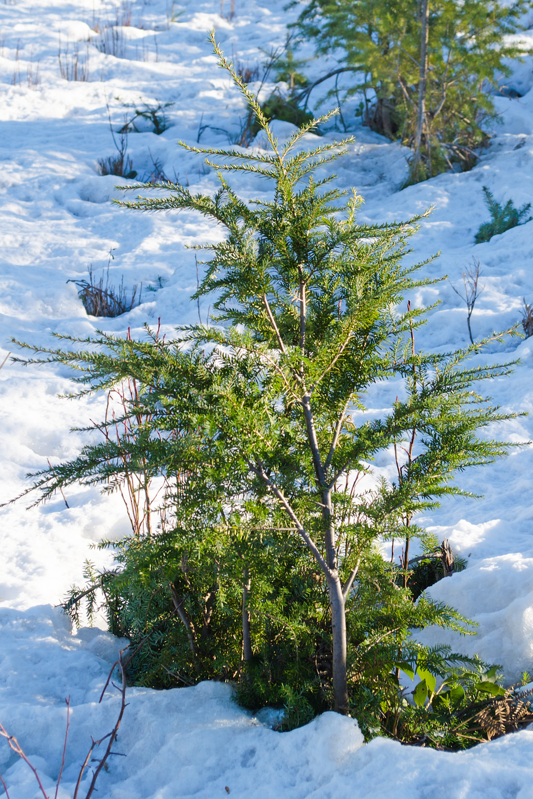
 Logged-off emptiness, and four seed trees.

Standing tall.

This method of harvesting a forest supposedly jump-starts the reforestation of the area. I don't know how effective it is.

The seed tree reforestation method leaves healthy, mature trees with a good cone crop (usually 6 to 15 per acre) in the existing stand to provide seed for regenerating a new stand of trees.  ... It is not unusual for a forest manager to leave the seed trees for wildlife or aesthetics objectives. (Thoughtco)
However, with so much of Vancouver Island logged off, and with climate change upon us, I'm wondering how long it will be before the forests re-establish themselves.

~~~~~~~~~~~~~~~~~~~~~~~~~~

Un terreno denudado de su bosque, con cuatro árboles dejado en pie para proveer semillas para la reforestación.

Se dice que este método de cosecha de nuestros bosques ayuda a la repoblación forestal. No sé si funciona.

El método de reforestación por medio de árboles semilleros deja árboles maduros y sanos con una producción óptima de piñas (normalmente de 6 a 15 por acre (0,4 hectárea) en pie para proveer semillas para regenerar un nuevo bosque. ... No es raro que un silvicultor deje los árboles para la fauna silvestre y consideraciones de estética. (Thoughtco)

Sin embargo, con tanto de la isla Vancouver ya desnudado, con el cambio de clima que ahora se presenta, me pregunto cuánto tiempo tomará para que se reestablecen nuestros bosques.

Wednesday, September 23, 2020

Glacier spoor

Fire up your imagination. Speed time up. Faster! Faster! Faster! Now go back a few millennia.

A Kraken rises out of the sea to the west of the continent, pushes into the sky, steaming, its flesh bubbling like a stew pot, hardening as it cools into grey rock, but still on the move. As it lifts into the cold air, it collects a white and blue coating of ice, thousands of metres thick. Rises still more; ice slides off slowly back into the ocean, creaking and grinding and scraping, carrying patches of the old skin with it, dropping pieces as it melts. The rocks bounce as the weight lifts, buckling and folding, cracking, surrendering more chunks to the retreating ice.

Slow time down again. Here we are. The Kraken appears to sleep under a green coverlet. Sometimes it shivers in its dreams.

That's Vancouver Island, from the tall basalt peaks to the pillow lavas in the interior, to the glacial erratics abandoned on the seashore, with the forests and seaweeds that clothe it.

At one end of a wide, sandy beach, the glaciers left their tracks ...

Long rock channel, shore to low tide mark.

Seaweed and small animals soften and pockmark the rocks.

Tide pool. Green sea lettuce, rockweed,and a red alga. In the pool, but hiding because of my shadow, many tiny fish.

I call it the mushroom rock. Pitted by limpets and anemones, sprinkled with barnacles.

Interface; muddy sand behind me, rocks and seaweed ahead.

~~~~~~~~~~~~~~~~~~
Despierta tu imaginación. Imagínate que el tiempo se acelera. Más. ¡Más! Más rápido! Ahora regrésate unos cuantos milenios.

Un monstruo marino se alza desde el fondo del mar al oeste del continente; se levanta hacia el cielo, humeante, hirviendo: parece una olla rebosante. Se enfría al contacto con el aire, y su cuerpo se endurece, volviéndose roca, pero aún en movimiento. El aire está helado; las rocas se cubren de hielo blanco y azul, cientos de metros de hielo. Como sigue subiendo ese monstruo, el hielo se desliza cuesta abajo, hacia el mar, crujiendo, quejándose, raspando y  moliendo mientras va llevando consigo pedazos gigantescos de roca, dejándolos al azahar cuando se derrita. Las rocas, libres del peso de tanto hielo, se rebotan, doblándose, agrietándose, abandonando más de su materia al hielo en retiro. ...

Vuelve el tiempo a sus velocidad normal. Aquí estamos. El monstruo parece dormir, bajo una cobija verde. A veces se estremece entre sus sueños.

Esta es nuestra isla, Vancouver Island, desde las cimas basálticas y las almohadillas de lava, hasta los bloques erráticos abandonados en la costa, todo cubierto de bosques y algas marinas.

A un extremo de una playa arenosa, los glaciares dejaron sus huellas ...

En las fotos, las rocas están cubiertas de algas verdes y rojas, de balanos y anémonas y lapas, los dos últimos que hacen los agujeritos en las rocas.


Saturday, July 25, 2020

Rock-hard pillows

About those lumpy rocks:

A friend sent me a link to a BC government pdf, dealing with the geologic structures of Strathcona Park, which encompasses the central part of the island at this latitude. In it, there is a good explanation of the lumps and bumps. It's pillow lava, ancient underwater lava bubbles. I'll quote from the pdf:

First, a bit of background, from that document.

"... beneath your feet lies a history stretching back 380 million years. It is a history of violent volcanic eruptions on ancient seafloors and quiet interludes when gardens of sea lilies waved in gentle ocean currents. It is a history of rocks torn and folded by the extraordinary forces which can move continents, and of mountain ranges sculpted by the immensely thick ice sheets which only vanished a few thousand years ago."

"The first volcanoes: 380 to 360 million years ago
During the Devonian Period a long gently-curving arc of volcanoes was built by explosive eruptions in the deep eastern Pacific Ocean. These undersea mountains were built up by successive volcanic eruptions and were subject to massive rock slides cascading down their slopes."

These early volcanoes were those that formed the core of the Buttle Lake region.

BC Gov. map, with my added arrow. The Buttle Lake region is that brown patch.

Now those lumpy rocks:

Karmutsen Formation
This 6500-metre-thick pile of basalt flows ... is the most abundant rock unit in the park. About half the mountains, including the highest ones, are carved from these basalts. This formation has a characteristic look from afar; being prominently layered in thick beds and forming reddish-brown dome-shaped peaks. It is also unique close up, as the pillowed form of much of the lava is very distinctive."
These pillow lavas form when basaltic lava erupts under water and is partially chilled by contact with the water. The lava thereby forms a rubbery skin through which more hot lava keeps flowing and expanding. This expansion results in ruptures of the skin and new balloon shaped buds and branches, some of which break off and roll down the slope of the sea floor to form pillows. Over time, the steady submarine eruption of lava, from cracks and fissures, built up a thick, extensive pile of these pillow lavas which totally blanketed the older rocks. They form most of the mountains west of Buttle Lake and south of Upper Campbell Lake and Elk River.
You can see the pillow shapes readily in road cuts along the mine road from about 1.5 kilometres south of park headquarters to beyond Lupin Falls.

Just another cliff face. Composite photo, focus stacked side to side. On the upper right, some pillows are visible.

All this was happening on the sea bed; the pillows formed underwater. With time, the whole shebang moved east and crumpled up to form tall mountains well above water.


I'm halfway through reading the pdf. And already it has cleared up another mystery for me. I'll post about that soon.

~~~~~~~~~~~~~~~~~~

Una amiga me envió un enlace a un documento del gobierno de BC, que explica el misterio de esas rocas redondeadas. Son lava/almohada.

Una traducción aproximada de esta explicación:

... bajo tus pies se extiende una historia que abarca 380 millones de años. Es una historia de erupciones volcánicas violentas en el fondo del mar antiguo y de intervalos tranquilos durante de los cuales jardines de crinóideos (lirios de mar, un animal del filo de los equinodermos) se mecían en los corrientes suaves del oceano. Es una historia de piedras arrancadas y plegadas por las fuerzas extraordinarias que mueven los continentes, una historia de sierras esculpidas por las inmensamente gruesas masas de hielo, las cuales apenas desaparecieron hace unos cuantos miles de años.

Los primeros volcanes: de hace 380 a 360 millones de años:
Durante el período Devónico un arco largo volcánico se formó a causa de erupciones explosivas en las honduras del este del oceano Pacífico. Estas montañas bajo el mar fueron construidas por medio de erupciones consecutiva, se moldeaban por enormes caídas de roca que se deslizaban en sus cuestas.

La formación Karmutsen
Este montón de basalto, de 6.500 metros de grueso es la unidad más común de roca en el parque. Más o menos la mitad de las montañas, incluyendo a las más altas, están formadas de estos basaltos. La formación tiene un aspecto característico vista desde lejos; siendo ordenada visiblemente en capas gruesas y formando cumbres redondeadas de color café rojizo. También de cerca es único, pues la forma de almohadas de mucho de la lava es inconfundible.

Estas lavas acojinadas (almohadillada) se forman cuando lava basáltica hace erupción bajo agua, y el agua la enfría parcialmente. Esta lava enfriada compone una corteza plástica, a manera de hule, cubriendo el flujo de lava fresca, la cual sigue fluyendo y dilatándose. Se rompe esta corteza, y se forman burbujas y nuevas ramas, algunas de las cuales se separan y ruedan cuesta abajo para formar cojines en el fondo del mar. Con el tiempo, la constante erupción submarina de lava desde grietas y fisuras contryó una gruesa capa de estas almohadilladas hasta totalmente cubrir la piedra antigua. Esta capa constituye la mayor parte de las montañas al oeste de Buttle Lake y al sur de Upper Campbell Lake y el Río Elk.

Se pueden ver claramente las formas acojinadas donde se ha cortado la roca para construir el camino desde unos 1,5 kilómetros al sur de la oficina del parque hasta más allá de la Caída Lupin.

Todo esto pasó en el fondo del mar; los cojines se formaron bajo agua. Con el tiempo, todo se trasladó al oeste, apachurrándose contra el continente para formar las altas montañas de nuestra isla.

Apenas he leído la mitad del documento, y ya se me ha aclarado otro misterio. Escribré sobre eso pronto.


Sunday, October 06, 2019

It's a jungle in there

"Rugged". That word comes up repeatedly in descriptions of Vancouver Island's terrain. And with reason.

Bear Creek wetland creek, off Oyster River. The circles in the water are from resident salmon.

Processing photos from Tuesday's trip to the salmon hatchery, I was impressed again by how impenetrable our bush is. The photo above is in an area that has been logged off repeatedly, cleared, cleared again; "managed". It is barely a dozen steps from the holding tanks for salmon fry (I was standing on the plank bridge beside the first tank), a stone's throw (thrown by me, with my old, gimpy shoulder) from the fence and the Oyster River Enhancement Society main office.

And yet: try walking through that! Scrambling, rather, sometimes using both hands as well as feet. Carefully, though; there's Devil's Club in those bushes, amply deserving of its name, and cunningly disguised as harmless thimbleberry bushes. And sudden pit traps, hidden under coats of moss or dead leaves. And trailing blackberry vines to grab your ankles and tip you over. And fallen trees barricading any clear spaces, clear only because the tree knocked over the Devil's Club on the way down.

The creek looks walkable, but watch out for waist-deep silt pools, looking as if they're only inches deep. And slippery, slidy slime. And more fallen branches, only half-anchored in the mud, ready to roll underfoot or to jump up and swat you. You'll need a good, sturdy stick; two feet aren't enough.

A few steps up the slope: cleared space beside the gate. Maple, cedar, evergreen fern, young alders, and blackberries. There are always blackberries. Give it a couple of years, and you'll need a machete to get to the sign.

It's the rain that does it. The rain, and the mild seasons, never too hot, never too cold. The rain and the mildness and the "intricate topography" (another synonym for "ruggedness"). And the isolation: a ten-minute drive from the populated coast takes us into bush untouched by anyone but the occasional loggers and fishermen. Who mostly stay on the trails, because it's too hard to cross that bush without land-clearing machinery.

It's bear country. The bears had been at the tanks the night before we arrived, leaving the leftovers from their breakfast for the ravens and the crawdads. They walk through this bush as if it were a highway. On all four feet, of course. And wearing thick, protective, furry armour against the Devil's Club.

Sunday, March 24, 2019

Looking up, looking down, looking across

Views from the Ridge Trail.

From a point where the trail came to the edge of the ridge, looking down at the river below.

Looking up. Crown shyness in evergreens.

Crown shyness ... is a phenomenon observed in some tree species, in which the crowns of fully stocked trees do not touch each other, forming a canopy with channel-like gaps....The phenomenon is most prevalent among trees of the same species, but also occurs between trees of different species. (Wikipedia)

'Way up top; pinkish buds. Yay, spring!

Power line and mainland mountains.

At one point, this power line crosses the trail. It goes from the John Hart generating station down on the river, and leads to the Duncan Bay on the coast, 3 km. away. Since there are only low-lying islands between this spot and the mainland, there is a clear view to distant snow-capped peaks.

Area map. The small one on centre left shows the direction of the cut. The line ends in Ts'y-los Provincial Park.


Friday, September 15, 2017

Road to nowhere

On the map, the highway north to the tip of Vancouver Island is a single, wavy line, with a few side roads, at Woss (pop. 200), Sayward (311), Brown's Bay. Zoom in further, and pale lines appear: logging roads, mostly, or roads to camp or picnic sites. These are private roads, gravel or mud; they do not turn blue when you try to move Google's little observer to them. Many have warning signs: watch for logging trucks, which always have the right of way, even if there's no passing lane; head for the ditch, or the bush.

On the ground, however, roads into the bush multiply. Some are little more than a two-rutted path, with weeds growing in the ruts. Some have been carved out and gravelled. Most have no indication of where they lead, or who made them. On Google, they're dark or light lines among the hills, becoming invisible where the trees close in.

I follow one or two on each trip north. Some peter out after a couple of turns, ending up abruptly at undisturbed bush. Some go on and on and on, winding up hill and down; when the road becomes too rough for my little car, even at a crawl, I find a wider spot, and turn back. Once, I found a tiny lake, with a house on the far side; the road would have reached it, but I needed a 4x4 truck.

Some seem completely meaningless. A nicely gravelled entrance, a road leading down a hill for 50 yards or so, then a few swipes with earth-moving equipment, and nothing more. Why? Someone prospecting for building sites, this far from nowhere? Hopeful handloggers? I can't imagine.

At one of these, I stopped and hiked to the end of the cleared "road", too rugged for my car. There was a hill, a creek, some plastic trash (why is this always present, even out here?), a few mounds of debris, as if a backhoe had been scraping out a construction site until the order came through; "You're in the wrong spot, go home, contract cancelled." Or something to that effect.

Ma Nature's contracts are never cancelled. She was hard at work, re-populating the site.

Lichen on a log. There's always lichen.

Assorted lichen (the "big" pillars are Cladonia), and moss.

Haircap moss and lichen.

Eastern eyebright, Euphrasia nemorosa. I found these near Nimpkish Lake in July but wasn't sure of the species. This, I identified by the size of the flowers, counting the grass stalks as more than 1 mm across. E. nemorosa's flowers are from 5-10 mm long.

Bird's foot trefoil, Lotus corniculatus.

And there are always slugs. Banana slug, watching my camera.


Wednesday, September 13, 2017

Ahhhh! Grey again!

The Vancouver Island paint box relies on blue, green, and grey. Mostly grey. But over this dry, smoking summer, that has changed. Lawns are yellow and crispy; the air has been brown, the sunshine orange. Distant mountains, instead of blue and purple, were a smudgy mud colour.

When the rains finally started last week, I went out to the woods to rest my eyes on the new greys.

From Race Point, Looking across to Quadra Island

Mist over a valley. Near Brown's Bay Road, Hwy 19.

Muted rainforest greens

"The woods were lovely, dark and deep ..." (Robert Frost)

It was pleasant there, wandering in the slow rain, under the evergreens. The air was cool and damp; it smelled of moss. The only sounds were the quiet tree conversations; creaking and whispering; and the gentle pattering of falling fir needles. Far overhead, eagles circled, crossing and re-crossing the patches of visible grey sky.

Farther north, the rain had been and gone, but the mist remained.

Deciduous trees, blasted by unaccustomed heat, basking now in a blue-grey mist.

Not everything is grey. Blackberries, still green, are red.

The blackberries this year are ripening slowly. I've tried a few ripe ones; they're acid and hard. They need water, lots of water, and sunshine; this summer has been missing both.


Sunday, February 26, 2017

Icy lakes

The snow was gone here in Campbell River. I drove inland, crossing the island to see what it was like away from the warmth of the coastal waters. The snow still lay deep and frozen hard on the ground. Small ponds were frozen over; running water, in the ditches and creeks was still liquid.

And the lakes were  half and half.

Echo Lake. Snow on ice, melting at the edges under a warm sun.

Snakehead Lake.
I could walk on top of the frozen snow, but I don't think I'd try walking on that ice. It looks thin, somehow.

And it snowed again last night, covering my primulas again. Will winter never end? This time last year, I had forsythia blooming by my window, and the parks were bright with crocuses and snowdrops.

Monday, January 09, 2017

Mini-micro havens

It snowed again yesterday afternoon. Then the snow turned to rain. Our streets were black, then white, then black again. But just a few miles away, on the mainland, the black is bad news; there, it's black ice. And the snow keeps falling.

Closer to home, if I drive over the hill that borders the shore, I find snow, six inches deep, undisturbed, and frozen hard enough to walk on without leaving a mark.

New forest coming, under snow.

Here on Vancouver Island, we live in a microclimate, its temperature and humidity determined by the encircling ocean currents, northbound from the warm North Pacific Current. Our summers are cool and wet, and our winters are usually mild (and wet; we don't tan, we rust.) Some years, there's no snow at all.

But microclimates have their own microclimates. Our shoreline strip is one. The backside of the hill is another. Forested areas have their own variants, depending on height of trees, direction of the slope, extent of logged areas, nearby rivers, roads and their traffic, and other circumstances.

And then there are the mini-microclimates. The warm zones around blades of grass, the wells at the base of stumps, hollow logs, even the ruts in old car tracks. Each imperfection in the surface shapes the wind currents, captures or blocks the sunshine, funnels off the rainwater. And in these mini-climates, plants and animals wait out the cold weather.

Baby Douglas fir and shrubs, each in its own warm well.

Each living plant affects its climate in various ways. It absorbs sunlight, which otherwise bounces off the surface of the snow. It deflects drying winds. And its own living processes produce a minimal amount of heat. Enough to melt the snow up against the branches, and provide cover for other small plants.

An old stump in its own mini-climate, harbouring evergreen salal.

Two more stumps. With lichen, salal, and bare twigs of deciduous shrubs. These will have an early start to their spring growth.

A few small trees and shrubs share a warm spot.

Even a rock can build a mini-climate. It absorbs more warmth from the sun than the surrounding earth, which is cooled by air pockets and seeping ice melt. The rock radiates this extra heat into the snow around it.

Snow on the side of the road, tossed up by a snowplow. Even this can create a disturbance in air flow and sunlight. The lump itself, exposed to the wind, is frozen hard, but the sunny surface is slowly melting, making that icicle.

A side road, unmarked on the map, with ruts and tracks of a dog or coyote, made before the snow froze hard. The forested and ferny areas are just warm enough to melt off the snow before it freezes.

And there's another mini- or really, not so mini - microclimate, usually unseen. Underneath that frozen snow cover, the ground is protected from freezing winds, and stays just above freezing. And there, the little creatures wait out the winter, sleeping or burrowing deep into the warmish earth.

Back at home, a few of my spring crocuses are pushing through the wet soil, hidden in a mini-climate of their own between a wall and a staircase.

Thursday, December 22, 2016

Standing tall

I've been taking photos of trees as I wander about, whenever I can catch one off on its own. Here are a few of them, in grey winter light.

Bare deciduous trees:

In grey light and melting snow. Oyster Bay.

One crow. Oyster Bay

Silhouette against mid-day light. Oyster Bay Nature Preserve.

Sunset, from Jubilee Parkway.

Same two as the silhouette, but from the far side, on a slightly warmer day. With crows.

Alder, Tyee Spit.

And evergreens:

Growing tips. Buttle Lake

On the shores of Upper Campbell Lake

Tyee Spit

Loaded with cones.Oyster Bay.

A Skywatch post.

Saturday, October 22, 2016

Homeward bound

The north end of Vancouver island tends to the vertical. Rocky cliffs spring straight up from the shore, as if we were halfway up the mountainsides already. Which, if you consider the height from the nearby sea floor, up to a kilometre underwater, we are.

Even Campbell River, with its rushing rivers bringing down silt to lay out beaches along our shore, is mostly built on the hillside. The lower highway runs close to the beach; streets leading off it climb steeply. From a couple of blocks inland, we can see (on sunny days) across the low islands of the Discovery Passage to the mountains of the mainland.

Typical street view.Two blocks up.

I live on the first block above the highway, so that coming home at the end of the day, I'm usually curving down a side hill, watching the sweep of the strait below me. It's a good feeling, even when sea and sky are grey. And when the sun is shining, I almost hate to get home.

Looking across the Georgia Strait towards Powell River on the mainland. Mitlenatch Island dead centre ahead.


Lighthouse, Quadra Island

The opposite shore, and the mountains of the mainland. (With fresh snow.)

A Wikipedia map might be helpful here. We are at the junction of Discovery Passage and the Georgia Strait, which stretches on down to the Lower Mainland, and the beaches we used to frequent on the border.

Discovery Passage is 1.7 km wide between Campbell River and Quadra Island. (The view in the photo above.)

A Skywatch post.
Powered By Blogger