Showing posts with label coastal rainforest. Show all posts

Tuesday, November 25, 2025

Ghosts and mists and a sleepy lake.

The weather people said it wasn't going to rain all day. I went out early, just in case, and had to turn on my windshield wipers almost right away. The clouds seemed lighter off to the north; I took that highway.  At Roberts Lake, the trees were still dripping, but the rain had stopped.

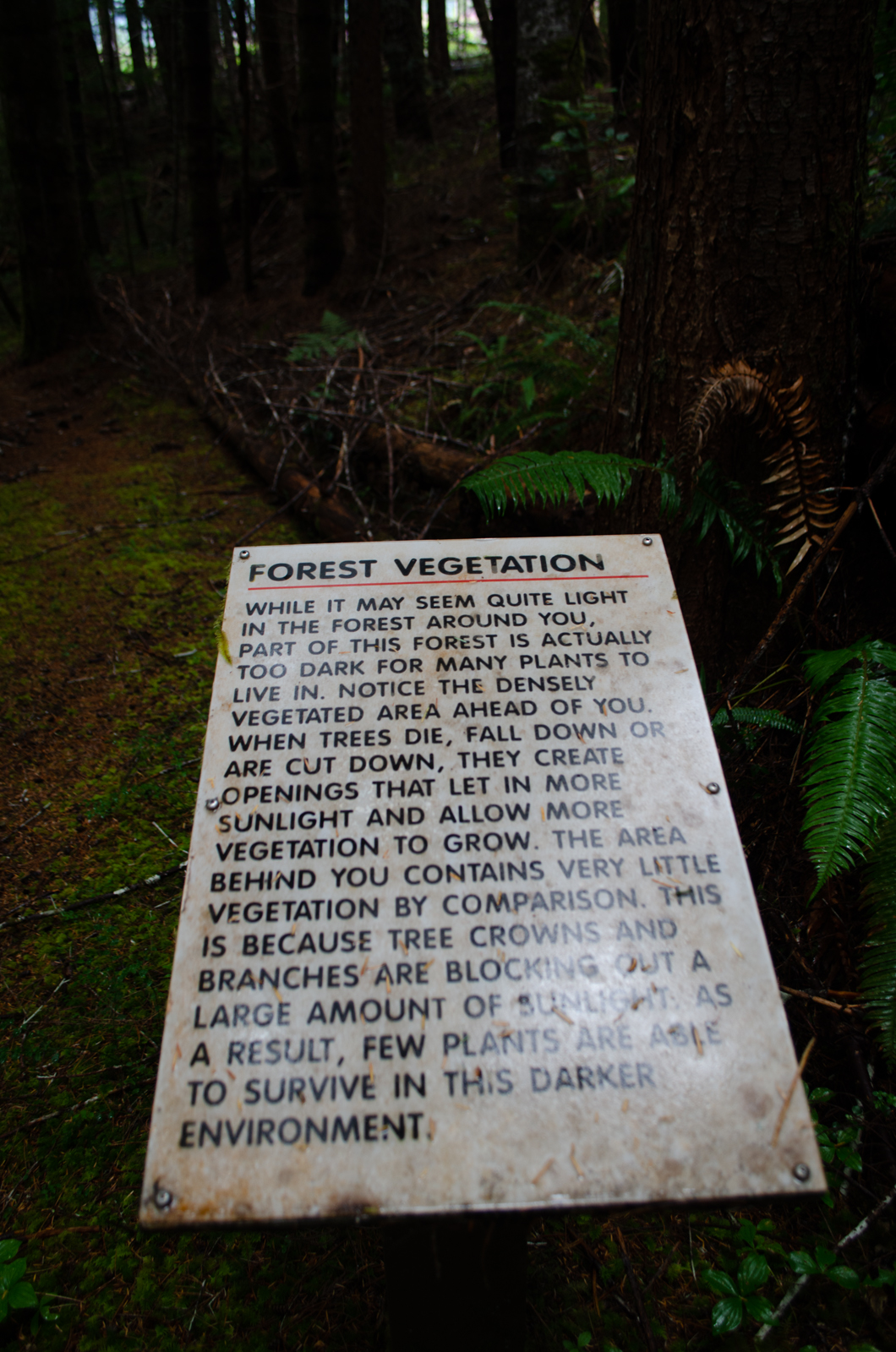
I reminded myself, starting down the trail, that I was going to look at the whole forest, the trees and the moss and the lake, and not be distracted by mushrooms. It has been all mushrooms, almost all the time, for too long.

It was cold and dark down there under the trees with no sunlight attempting to filter through, but the air felt clean, scented by dying needles and wet bark. (It's a pity that there's no way to transmit scents over the web; you'll just have to imagine it.) The only sounds were my footsteps and the occasional plop as another branch shook off its load of rainwater.

Ferns and trunks and moss. The bluish sky beyond the trees is over the lake.

Mist over the hills.

Down at the lake shore all the colours were muted; grey clouds had dropped down to cover all but the lowest hills. The only warmth, and that almost extinguished, was in the pinks of the alder catkins.

Sleeping lake. No birds, not even a lonely loon.

But oh, yes, there were mushrooms, insisting on being noticed.

Step moss and lichens and little white mushrooms.

The draped tan flags are the ghosts of vanilla leaves. They hang there, all through the forest, not crumbling, holding fast to their slender stems, waving nonchalantly in the breeze and the pouring rain, until the snow covers them and forces them down to the ground.

I'll leave the rest of the mushrooms until later. Moss and lichens first.

For comparison; here are vanilla leaf plants, in the spring.

A Skywatch post.
~~~~~~~~~~~~~

Los meteorológicos dijeron que no iba a llover hoy. Salí temprano, por si las moscas, y tuve que prender el limpiaparabrisas dentro de unos pocos minutos. Las nubes hacia el norte parecían estar menos densas, y escogí la carretera correspondiente. Cuando llegué al lago Roberts, ya no llovía, pero seguían cayendo gotitas desde la copa de los árboles.

Había decidido tratar de observar todo el bosque; los árboles, los musgos, el lago y lo demás, y no dejarme distraer con hongos; por un tiempo todo ha sido hongos, hongos, hongos. Bellos, pero ¿qué se me había escapado?

Bajo los árboles en este dia de finales de noviembre, hacía frio y había poca luz. El aire se sentía limpio, y llevaba aromas de agujas de abeto moribundas y de corteza de árbol húmeda. (Lástima que no hay manera de transmitir las aromas por el internet; pues tendrás que imaginártelas.) Oía solamente el sonido de mis pasos y de vez en cuando un "plop" de una gota haciendo impacto sobre los helechos.

    1. Helechos, troncos, musgos. Donde se ve el cielo tras los árboles es que el espacio se abre sobre el lago.

    2. Neblina cubriendo los cerros.

Saliendo de las sombras del bosque, llegué a la orilla del lago. Los colores se veían atenuados; verde oscuro, gris frio, café apagado; nubes espesas escondían la luz del sol. El único color con algo de calor, y eso apenas visible, se debía a las candelillas de los alisos rojos.

    3. El lago parece dormir. No se ve ningún pájaro, ni siquiera un colimbo solitario.

Pero sí había hongos, e insistían en ser observados; saltaban a la vista.

    4. Musgo de escalera, líquenes, y honguitos blancos. Lo que parece ser trapitos colgantes son las fantasmas de hoja de vainilla, Achlys triphylla. Se mantienen allí como banderitas esparcidas por todo el bosque sobre sus tallos delicados, sin desmoronarse, sin soltarse, agitándose cuando la lluvia cae con fuerza, meciéndose con las brisas suaves, hasta que por fin la nieve las cubre y las aplasta contra el suelo.

Dejo los demás de los hongos para más tarde. Primero voy a procesar fotos de musgos y de líquenes.

    5. Hoja de vainilla, en la primavera.

Wednesday, January 31, 2024

High water, green forest

The highway on its way out of town runs alongside the river, usually a tame ripple glimpsed through the trees. But yesterday, the water was higher and wider than I'd ever seen it, rampaging along, white-foamed. I abandoned my planned route and went to look.

View from the trail. The second channel, entering below the islet, is usually not visible.

It had been raining earlier, and for days before; everything was wet, and very green.

Moss everywhere. And Licorice ferns, Polypodium glycyrrhiza.

I followed the trail to my usual stopping point, and took a side trail to the edge of the water, which the trail had veered away from. The side hill is covered with evergreen ferns; below, salmonberry and huckleberry bushes fill the low spots, and all around are the trees, the alders and maples standing bare-armed against the sky, the evergreens providing a sheltering wall. The air on my skin was cool and felt wet. The only sounds were the chattering of the rushing water and, occasionally, the plop of a drip falling from soggy moss overhead. A faint whiff of wood smoke blended with the green scent of the evergreens. For a minute, there, I was a little girl again; for an instant, I could have run, shouting for delight, through the knee-deep ferns.

The moment passed. The years have run on, and my gimpy knee was threatening to go on strike. I turned and took the trail back to the parking lot. But I went slowly, stopping often, just to stand and stare.

Fantastic shapes on a moss-covered branch.

Quiet trail.

Mossy trunks

Just wondering; why does moss sometimes completely cover a tree, skip the next, then coat only the foot of another?
 
Moss and lichen on a broken log.

And it's raining again.

~~~~~~~~~~~~~~~~
La carretera, saliendo del pueblo, pasa al lado del rio, que se ve detrás de los árboles, una linea azul, tranquila. Ayer, en cambio, el agua había surgido a sus límites, y corría agitadamente, formando olas y espuma. Abandoné mis planes y fui a mirarlo.

Foto: La vista desde el sendero al lado del rio. El brazo del rio que entra al otro lado de la islita, normalmente no se ve.

Había llovido apenas hacía un par de horas, y todo estaba muy verde.

Foto: tronco con musgos y los helechos Polypodium glycyrrhiza, el helecho de raiz dulce.

Seguí el sendero hasta donde acostumbro detenerme, y luego tomé otro senderito que llevaba al mero borde del agua, del cual el sendero principal se había alejado. Allí, el declive está cubierto de helechos de hoja perennes, Polystichum munitum; cerca del agua abundan los arbustos de salmonberry, Rubus spectabilis, y arándanos rojos; alrededor, los árboles de hoja caduca, los arces y alisos, levantan brazos desnudos contra el cielo; los pinos y abetos, siempre verdes, forman un pared que nos aislan del mundo exterior. El aire se sentía fresco y húmedo. Todo lo que se oía era el parloteo del rio, y de vez en cuando una gota de agua que se caía "plop" del musgo empapado allá arriba. Me llegaba un aroma tenue de fuego de leña.

Por un instante, volví a ser una niña, viviendo entre estos bosques; por un segundo, sentí que podría correr, gritando alegre, entre los helechos.

Y pasó el momento. Como han pasado los años. Y mi rodilla mala estaba amenazándome con declararse en huelga. Regresé al sendero principal y me dirigí al estacionamiento. Pero lentamente, deteniéndome a cada rato para mirar lo que me rodeaba.

Fotos: 
  • Formas fantásticas de los musgos sobre una rama seca.
  • El sendero de vuelta.
  • Unos troncos con musgo. ¿Porqué sería que el musgo cubre algunos árboles por completo, mientras deja otros sin nada, o con musgos solamente en la base?
  • Musgos y líquenes sobre una masa de madera podrida.
Y está lloviendo otra vez.


Friday, October 14, 2022

In the green shade

Some random shots along the lower river trail. This is below the waterfalls, where the river broadens out on its way to the estuary.

A slow stream waters a multi-species forest.

Criss-crossing mossy branches

An old nurse log feeds 4 trees.

The back side of the same group, with my back to the light.

Dried-out looking conk. Maybe a tinder polypore.

Brown mushrooms on a tree. Much lightened; in the shade, they were barely visible.

Future nurse log, with two evergreen saplings, huckleberry and salmonberry youngsters.

~~~~~~~~~~~~~~~~~~~~~~~~~~~~~~~~~~~~
Algunas fotos del sendero que sigue el rio entre el bosque entre las cataratas y el estuario:

  1. Una de las ramas del rio nutre un bosque de muchas especies.
  2. Ramas de árbol cubiertas de musgo.
  3. Un viejo tronco nodriza que sostiene 4 árboles maduros.
  4. El lado opuesto de dicho tronco, con la luz a mis espaldas.
  5. Un hongo poliporo, tal vez el poliporo "yesca".
  6. Otros hongos, en un tronco de árbol. Le añadí luz a la foto; en vida, estaba todo tan oscuro que apenas se veían los hongos.
  7. Un tronco nodriza del futuro, ahora con dos arbolitos de hoja perenne, y brotes de huckleberry y salmonberry.  


Friday, May 06, 2022

Slow water, fast water, green water, blue water

It's a rain forest. Wherever you look, there's water. These are views from a short walk along the Campbell River.

Campbell River. With beaver lodge.

I hadn't seen the beaver lodge until I processed the photo. It's on the far bank, in the centre of the photo. Now I'll have to go back and take a closer look.

On the land side of the trail. Every dip in the terrain has its creek or pool.

A chunk of old root in a backwater.

Canyonview bridge.

This is the end of the trail for me, at least for now. I climbed the stairs and trail to the bridge last year and put my knee out of commission, so I turned back at the bottom this time. For now.

~~~~~~~~~~~~~~~~~~~~~~~~~~

Estamos en un bosque pluvial. Y dondequiera que miramos, hay agua. Estas fotos fueron sacadas en un tramo corto del sendero al lado del rio Campbell.

  1. El rio. Y una madriguera de castores al otro lado, en el mero centro. No la vi hasta que estaba procesando la foto en casa. Ahora tendré que regresar para verla más de cerca.
  2. Del otro lado del sendero, entre el bosque. Cada depresión del terreno tiene su riachuelo o lagunita.
  3. En un remanso tranquilo, una sección de raiz forma un túnel.
  4. El puente sobre el cañon. Para mi, ahora el final del sendero cae al pie de la escalera. Por ahora. Hice la subida el año pasado y me amolé la rodilla, así que está fuera de mi alcance. Por ahora.


Saturday, August 08, 2020

A walk in the dark

 I've been on the move a lot this week. Under a blazing sun, I returned to the wharf to look at critters under the floats. I went to see cliff faces beside Upper Campbell Lake below cotton-puff clouds. And in the pouring rain, I drove north to Hoomak Lake, and walked down sodden trails under dripping, gloomy trees.

I've been sorting and processing photos in no particular order, as the whim strikes. These are from the Hoomak Lake trails.

(I've been here before, in January of 2019. Posts here, here, here, here, and here.)

It stopped raining as I parked, but the sky was grey, the ground slippery, and raindrops, delayed by the branches overhead, gathered and dropped, making plopping noises.

First viewpoint over the lake. Rainy day lighting. 4:30 PM.

It was dark under the trees; the only light came from far, far overhead, through the leafy, needled canopy, or from narrow gaps in the vegetation along the shore. But where there was light, it was all very green.

Creek near the shore. Brown, rusty water.

The trails branch off; last time I took the "Short Trail". This time, I went down the long trail until I found another leg, going uphill and back. Longer than the short trail, but quite a bit shorter than the other.

Part way up the hill, I came across this sign:

The sign as I found it. With the lighting as the camera saw it. Facing the "lighter" part of the forest and the shore beyond.

I straightened the photo and cleaned it up a bit to make it easier to read. And this is the lighting as the automatic photoshop program thought it should be. Not how I saw it on site.

"Forest Vegetation" sign

Text: Forest Vegetaion:
While it may seem quite light in the forest around you, (because our eyes adjust) part of this forest is actually too dark for many plants to live in. Notice the densely vegetated area ahead of you. When trees die, fall down or are cut down, they create openings that let in more sunlight and allow more vegetation to grow. The area behind you (no photo) contains very little vegetation by comparison. This is because tree crowns and branches are blocking out a large amount of sunlight. As a result, few plants are able to survive in this darker environment.

And of course, it was much darker this afternoon, because of the clouds overhead.

These little cardboard signs have been added since I was here last. Most are nailed to trees. This one had fallen, and ended up propped soggily in a rotting stump.

This trail went uphill, back down, back up, across several bridges and many informative signs, and finally joined the old Short Trail and went back to the parking lot. I'll post bridge photos tomorrow, some plants next.
Looking straight up from the hillside.


~~~~~~~~~~~~~~~~~~

Esta semana he estado en muchas partes. Bajo un sol abrasador, fui otra vez al muelle para mirar las criaturas que viven bajo los flotadores. Fui a ver las grandes rocas que bordean el Lago Upper Campbell, bajo un cielo de nubes de algodón. Y fui al norte, al Lago Hoomak en una tormenta de lluvia, llegando al estacionamiento justo a tiempo para caminar en una pausa de la lluvia.

He visitado este lago anteriormente, en enero del año pasado. Arriba hay enlaces a lo que escribí entonces.

Era una tarde muy oscura, sobre todo bajo los árboles. Árboles mojados, todavía dejando caer grandes gotas de la lluvia retenida. El suelo estaba empapado y algo resbaloso. La única luz venía de muy arriba, o entre ramas, del lago.

Hay muchos senderos aquí. La última vez tomé el "Corto". Esta vez empecé en el sendero "Largo", pero luego vi otro que subía el cerro y lo seguí.

Encontré un letrero que habla de la oscuridad del bosque y sus resultados.

Cuando no hay suficiente luz, hay poca vegetación. Los árboles aquí, muy cerca el uno del otro, corta la luz. Hacia el lago, hay más plantas; en el cerro, pocas plantas pueden vivir.

El caminito subía y bajaba y volvía a subir. Cruzó un puente tras otro; hay muchos pequeños riachuelos en este bosque lluvioso. Mañana subiré fotos de puentes, y luego algunas plantas interesantes que hallé.


Friday, May 15, 2020

Messy

Wherever the local forests are a mix of deciduous and evergreen trees, closely packed together to keep out the sunlight, mosses climb up the trunks and drape themselves from the branches, sometimes engulfing the entire tree in a thick, messy blanket or hanging like shredded curtains in a house with too many cats. One of those trees was growing at the foot of a cliff, so that I, up top, was able to get near the branches.

Cat's tail moss.

This moss is quite variable in habit and shape, depending on its location, and accordingly has a variety of names. Isothecium myosuroides, to start. And in common parlance, cat-tail, mouse tail, thread moss, tree moss. I've been calling it "messy moss".

It grows on rocks or trees, preferably deciduous trees. The evergreens are often too acid for its taste.

Getting closer. Still messy. It doesn't seem to have left any space for the tree's own leaves.

From my guide book: "At some localities, every tree branch is covered by cat-tail moss."
~~~~~~~~~~~~~~~~~~~~

Donde el bosque de por aquí consiste en una mezcla de árboles de hoja perenne y de caducifolios, suficientemente arrimados como para bloquear la luz del sol, unos musgos se trepan por los troncos y se cuelgan de las ramas: a veces envuelven todo el árbol en una cobija desaliñada o haciendo cortinas en jirones como si estuvieran en una casa con demasiados gatos.

Un árbol crecía junto a un acantilado, así que yo, parada al borde, pude llegar cerca de las ramas.

El musgo es Isothecium myosuroides, también conocido como musgo "cola de gato" o "cola de ratón". Como es muy variable, según donde crece, se le han dado otros nombres, como por ejemplo, musgo hilo, musgo de árbol (porque no crece en el suelo). Yo, sin haberlo visto de cerca, lo he estado llamando "musgo desarreglado".

Crece en rocas, pero no en acantilados, en troncos caídos, pero no en el suelo. Y sobre todo, en árboles caducifolios; los de hoja perenne son un poco ácidos para su gusto.

Mi libro guía menciona que en algunos lugares cada rama está cubierta de musgo cola de gato.

Sunday, November 10, 2019

Buttle Lake; a bit of history

Large areas of Vancouver Island have been historically untouched by humans. The terrain is too rugged; the rainforest too dense, the climate too inhospitable; even the inland waterways are forbidding. Most settlements have been along the coast, accessible by boat. (Dugout canoe, in the old days.)

For example:
What was described as a first class trail between Nanaimo and Comox had been completed in May 1863 ... When Brown explored up the island in August 1864, [15 months later] he found the trail blocked by windfalls and washouts, although he did find one bridge remaining at the Qualicum River. (Vancouver Island Exploring Expedition 1864)
An easy trail to follow through the bush. Google maps photo, Karst Creek trail.

Buttle Lake, running down the centre of the island, between steep mountains, was discovered first by Europeans in 1865. (If First Nations people had been there earlier, they have left no trace. That we have found.)  John Buttle, with the Vancouver Island Exploring Expedition, discovered the lake in 1865, probably following a chain of lakes and rivers upstream from the coast. Buttle Lake is the first of the lakes and rivers that feed into the Campbell River.

Buttle Lake from Auger Point, looking downstream.

The lakes were smaller back then: in 1958, the BC Power Commission dammed the Campbell Lake, raising the water level 30 metres, dividing the lake into Upper and Lower Campbell Lakes. The water backed up into Buttle Lake, raising it by 5 metres. These days, when the water is low, the stumps of the old drowned forest are still visible on the bare shores.

Near the north end of the lake. The water is low, although the rains have started.

Remains of a drowned forest.

Island, mid-lake.

There is an interesting set of photos on a UVic library page, Before Strathcona Dam. Two photos of the same area of Upper Campbell Lake, taken in 1950 and 1959, are layered, with a slider to show how the lake grew. Worth looking at.

A Skywatch post.

Sunday, October 06, 2019

It's a jungle in there

"Rugged". That word comes up repeatedly in descriptions of Vancouver Island's terrain. And with reason.

Bear Creek wetland creek, off Oyster River. The circles in the water are from resident salmon.

Processing photos from Tuesday's trip to the salmon hatchery, I was impressed again by how impenetrable our bush is. The photo above is in an area that has been logged off repeatedly, cleared, cleared again; "managed". It is barely a dozen steps from the holding tanks for salmon fry (I was standing on the plank bridge beside the first tank), a stone's throw (thrown by me, with my old, gimpy shoulder) from the fence and the Oyster River Enhancement Society main office.

And yet: try walking through that! Scrambling, rather, sometimes using both hands as well as feet. Carefully, though; there's Devil's Club in those bushes, amply deserving of its name, and cunningly disguised as harmless thimbleberry bushes. And sudden pit traps, hidden under coats of moss or dead leaves. And trailing blackberry vines to grab your ankles and tip you over. And fallen trees barricading any clear spaces, clear only because the tree knocked over the Devil's Club on the way down.

The creek looks walkable, but watch out for waist-deep silt pools, looking as if they're only inches deep. And slippery, slidy slime. And more fallen branches, only half-anchored in the mud, ready to roll underfoot or to jump up and swat you. You'll need a good, sturdy stick; two feet aren't enough.

A few steps up the slope: cleared space beside the gate. Maple, cedar, evergreen fern, young alders, and blackberries. There are always blackberries. Give it a couple of years, and you'll need a machete to get to the sign.

It's the rain that does it. The rain, and the mild seasons, never too hot, never too cold. The rain and the mildness and the "intricate topography" (another synonym for "ruggedness"). And the isolation: a ten-minute drive from the populated coast takes us into bush untouched by anyone but the occasional loggers and fishermen. Who mostly stay on the trails, because it's too hard to cross that bush without land-clearing machinery.

It's bear country. The bears had been at the tanks the night before we arrived, leaving the leftovers from their breakfast for the ravens and the crawdads. They walk through this bush as if it were a highway. On all four feet, of course. And wearing thick, protective, furry armour against the Devil's Club.
Powered By Blogger