Showing posts with label Canyonview bridge. Show all posts

Wednesday, February 26, 2025

Access restored!

I'm celebrating a minor victory: four years ago, in July, I climbed the staircase and trail to the Canyonview bridge, far above the river below. I took it too fast, and put my knee out of commission, leaving that trail and many others out of reach ever since then. But I was at the bottom of the hill last week and decided to  climb just a few steps, carefully. Just a few; I would stop as soon as the knee started to lock up. A few steps, a few more, even more. Taking it slowly, I got to the top without pain. And down again.

Yay!

So here's the view from that bridge, again.

Looking downstream. In the July photo, the John Hart generating station was hidden behind trees, bare now in winter. There's a bufflehead just landing on the blue water below.

The last bit of the enclosed canyon. With the bufflehead.

And from the upstream side of the bridge. The river makes a 90° angle here, coming through a deep, narrow gorge; some ways back it turned at another 90°, making three sides of a rectangle. No trails look over this bit of river; I wonder why.

And my knee is still good. Other hills, at Buttle Lake, Lupin Falls, Karst Creek, Myra Falls, within reach again for this summer!

~~~~~~~~~~~~~~~~

Estoy celebrando una victoria pequeña. Hace cuatro años, subí la escalera y el sendero que sigue hasta llegar al puente que cruza el cañón, muy por encima del rio abajo. Me apuré demasiado, y arruiné una rodilla, lo que puso ese sendero y muchos otros fuera de mi alcance desde entonces. Pero estando al pie de la escalera la semana pasada, decidí subir unos cuantos escalones, con cuidado. Unos pocos, solamente, y regresaría en cuanto la rodilla se empezara a fallar. Unos cuantos escalones, unos pocos más, y  más. Tomando mi tiempo, llegué al puente sin dolor. Y de regreso, también.

¡Qué gusto!

La vista desde ese puente, otra vez.

  1. Mirando rio abajo. En la foto de Julio de hace cuatro años, la estación generativa John Hart se escondía tras de los árboles, que ahora en invierno están sin hojas.
  2. El último tramo del rio antes de salir del cañón. Hay un porrón coronado en el centro.
  3. Y mirando desde el lado opuesto del puente, al rio que viene bajando. Se dobla aquí, formando un ángulo de 90°, saliendo de un cañón muy estrecho, muy hondo. Rio arriba, hace otro ángulo de 90°, formando tres lados de un rectángulo.  Y no hay ningún sendero que mira hacia esta sección del rio, no entiendo porque.
Y mi rodilla sigue sana. Quiere decir que otros senderos, en Buttle Lake, las cataratas de Lupin y de Myra, Karst Creek, todos pueden figurar en mis planes para este verano. Estoy feliz.

Monday, February 24, 2025

Rocks, river, duck

That said, this island surrounds me with beauty; so healing!. Here, views seen in a brief stop while I was looking for lichens along the river bank; the exit from the narrow gorge:

Campbell River, coming out into the open. With bufflehead. The sign reads, "Warning", and then (unreadable from here) a notice about a siren announcing sudden volume changes. The flow can go quickly from a usual 80 cubic metres per second to 128 m³/s. Retreat to higher ground!

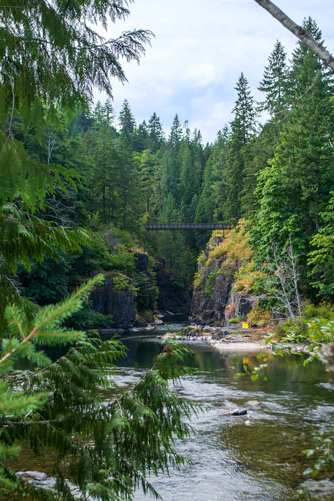
A wider view, with the Canyonview bridge far above. A long staircase leads up the hill to cross it and access a trail going along the far side of the river.

Ghostly trees on the far side of the river at this point. Red alders, bearing their spring-blooming brownish pink catkins and last winter's cones.

And I climbed those stairs again. Views from up top, tomorrow.

~~~~~~~~~~~
Esta isla me rodea de belleza. Esto es lo que vi cuando me detuve un momento durante una búsqueda de líquenes cerca del rio.
  1. El rio Campbell sale del cañón. Con un porrón coronado. El letrero lee —AVISO — y luego (esto apenas se puede leer a esta distancia) una advertencia; el corriente puede aumentarse súbitamente, pasando del acostumbrado 80 metros cúbicos por segundo a unos 128 m³/s en poco tiempo. ¡Retírense a un sitio fuera de su alcance!
  2. Una vista más amplia, incluyendo el puente "Vista del Cañón". Una escalera larga sube por la ladera a la izquierda, para cruzar el puente y seguir un sendero que sube el cerro al otro lado del rio.
  3. Árboles blanqueados al lado opuesto del rio. Son alisos rojos, y llevan los amentos de esta primavera, color café con tonos de rosa, y algunos de las piñitas del año pasado.
Y luego subí la escalera. La vista desde arriba, la dejo para mañana.


Friday, May 06, 2022

Slow water, fast water, green water, blue water

It's a rain forest. Wherever you look, there's water. These are views from a short walk along the Campbell River.

Campbell River. With beaver lodge.

I hadn't seen the beaver lodge until I processed the photo. It's on the far bank, in the centre of the photo. Now I'll have to go back and take a closer look.

On the land side of the trail. Every dip in the terrain has its creek or pool.

A chunk of old root in a backwater.

Canyonview bridge.

This is the end of the trail for me, at least for now. I climbed the stairs and trail to the bridge last year and put my knee out of commission, so I turned back at the bottom this time. For now.

~~~~~~~~~~~~~~~~~~~~~~~~~~

Estamos en un bosque pluvial. Y dondequiera que miramos, hay agua. Estas fotos fueron sacadas en un tramo corto del sendero al lado del rio Campbell.

  1. El rio. Y una madriguera de castores al otro lado, en el mero centro. No la vi hasta que estaba procesando la foto en casa. Ahora tendré que regresar para verla más de cerca.
  2. Del otro lado del sendero, entre el bosque. Cada depresión del terreno tiene su riachuelo o lagunita.
  3. En un remanso tranquilo, una sección de raiz forma un túnel.
  4. El puente sobre el cañon. Para mi, ahora el final del sendero cae al pie de la escalera. Por ahora. Hice la subida el año pasado y me amolé la rodilla, así que está fuera de mi alcance. Por ahora.


Friday, July 16, 2021

From the Canyonview bridge

Looking at trail maps around the Campbell River, I saw a photo of a pedestrian (one at a time) bridge high over the river, a bridge not marked on most of the trail maps, but there was this one photo. I had to go see it.

The bridge from the first vantage point.

The trail starts at the John Hart generating station, and at first goes through walled-off alleys between the river and the station; there's an open spot with benches, photos of the underground workings, and totem poles, and then more alleys, with a hidden entrance. Once around the corner, though, you come out to a view of the river. And a staircase, a couple of hundred steps going up the hillside, flanked by blackberry bushes. Then a trail, still climbing. A short drop, a curve, and the bridge over a narrow canyon at the bottom. Then the trail goes on, climbing again. I stopped at the bridge.

The view downstream. The white buildings behind the trees on the right are the generating station..

And the view looking upstream from the centre of the bridge.

The view from the far end of the bridge.

I went off the path to the top of the rocks, to get a higher view. And from there, I could see around the bend in the river.

And what's that down there in the water?

Some sort of spinning device, anchored in mid-stream.

The river is narrow and shallow here, since most of the water is piped through the station's three generators. But the water level is lower, too; you can see the white, scoured rock where the water reaches in wetter seasons.

But what is that spinning thing?

~~~~~~~~~~~~~~~~~~~~~

Viendo mapas de senderos alrededor del rio Campbell, encontré una foto de un puente que no había visto; un puente para peatones, un puente angosto, donde hay que pasar en fila. Pues tenía que ir a verlo.

Primera foto: el puente desde el primer lugar donde salió a la vista.

El camino empieza en la planta hidroeléctrica John Hart, y al principio pasa entre paredes que esconden tanto la planta como el rio. Luego hay un area con asientos, fotos informativos sobre la planta subterránea, y postes tótem; después sigue el camino entre paredes por un poco, y por fin salimos a campo abierto. Y a una escalera que sube el cerro; unos doscientos escalones. Luego un sendero sigue subiendo, una curva, y allí abajo está el puente. El camino sigue, subiendo aun; yo allí me detuve.

Segunda foto: La vista desde el puente, mirando rio abajo. Los edificios que se ven tras los árboles son los de la planta generadora.

Tercera foto: la vista desde el centro del puente, mirando rio arriba.

Cuarta: desde el final del puente.

Me salí del camino para subirme a las rocas para una mejor vista del rio. Y desde allí, pude ver más allá de la curva en el rio.

Quinta y sexta fotos: ¿Y qué es esa cosa que gira y gira allí abajo?

El rio es angosto y lleva poca agua aquí; la mayor parte del agua se ha desviado hacia las tres generadores de la planta subterránea. Pero en esta temporada, también el nivel del agua ha bajado; se ve la roca blanca que en otras temporadas estaría cubierta de agua.

¿Pero, qué sería esa cosa en el agua?
Powered By Blogger