Showing posts with label Georgia Strait. Show all posts

Saturday, April 25, 2026

Breathe.

 Just resting my eyes*.

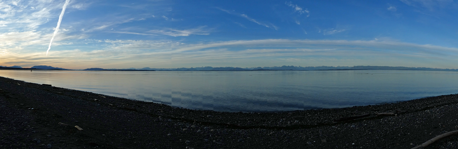
Lower Mainland peaks and Georgia Strait islands, from Stories Beach, Vancouver Island.

*Also lowering my blood pressure.

A Skywatch post.

~~~~~~~~~~~~

Una pausa para descansar la vista.*

Montañas nevadas de la costa del continente, y algunas islas del Estrecho de Georgia, vistas desde la Playa Stories, aquí en la isla Vancouver.

*Y también sirve para bajar la presión sanguinea.

Un post de Skywatch.

Monday, July 21, 2025

Light in the sky

I caught these views from the shore a few minutes before dawn.

Discovery Passage/Georgia Strait, 5:15 AM.

Turning a bit to the south, one minute later. 

A Skywatch post.
~~~~~~~~~~~~~~~
Fotos del Estrecho de Georgia, unos cuantos minutos antes del amanecer.
  1. 5:15 AM.
  2. Girando un poco hacia el sur. 5:16 AM.


Sunday, March 23, 2025

Medicine for my eyes

I've been peering at tinies, straining to see distant birds against the light, sorting photos of millimetre-long lichen squamules; now I need a long view, sea and sky and faraway mountain peaks, to rest my eyes.

View from the dike, Oyster Bay. Looking northeast towards the BC mainland.

From the shore beyond the dike. The snowy peaks are on the mainland, the nearest 100 km away. With one of those distant birds; a gull in the clouds.

I always pause to look at Mittlenatch Island in the centre of the strait. It stands alone, refusing to wear the coastal rainforest green.

Zooming 'way in. You can almost see the big California sea lions resting along the water line. They'll be there until mid-summer.

Mitlenatch Island (11 km. from my spot on the shore) lies in a rain shadow; rain falls here, and over on the islands behind it, but rarely on Mitlenatch. So it is mainly bare rock, with a top dressing of grasses. There are even flowering cacti!

Now, back to those lichens.

A Skywatch post.
~~~~~~~~~~~~~~

He estado examinando flores miniaturas, tratando de ver pájaros contra la luz en la distancia, revisando fotos de escamas de liquen midiendo uno o dos milímetros; ahora necesito refrescar los ojos con una vista amplia. Mar y cielo y nieve en las montañas lejanas; medicina para ojos cansados.
  1. Vista desde el dike en Oyster Bay, mirando al noroeste, hacia el continente.
  2. Vista ahora desde la playa. Las montañas nevadas están en el continente; la más cercana a unos 100 kilómetros de esta isla.
  3. Siempre me detengo a mirar la isla Mittlenatch, situada en el centro del estrecho, a 11 km. desde esta playa. La isla se encuentra bajo una sombra de lluvia; recibe menos de la mitad de la cantidad de lluvia que cae aquí o en las islas del otro lado del estrecho, con el resultado de que la isla consiste principalmente de roca expuesta, con hierbas bajas adornando las grietas en la roca. ¡Hasta hay cactus que florecen cada verano!
  4. Haciendo zoom. Casi se pueden ver los leones marinos de California que duermen en las rocas a la orilla; permanecerán en estas rocas hasta mediados del verano.
Y ahora, regreso a los líquenes.

Thursday, December 19, 2024

Almost looks summery

 It stopped raining. The sun came out. The clouds overhead evaporated. Amazing!

I went to walk along the shore near our Big Rock.

Big Rock, little rocks.

Big Rock is a boulder 10 metres high. I searched for a weight, couldn't find even an estimate, so I calculated my own, rounding off numbers; counting it as a sphere 30 ft. in diameter, probably granite (175 pounds per cu. ft.) gives me 6,3000,000 pounds, or 3,150 tons. Or about 3,000 little cars like mine.

Cell phone photo. Tip of Quadra Island.

Looking south to Willow Point.

This is a newly-"improved" (paved, fenced) walk along the central shoreline of Campbell River. Two new additions were these driftwood birds on their nests.

Loon. I don't know who built it.

Spiky eagle.

Real, live birds were not so co-operative, and mostly far away.

Harlequin ducks, two males, one female.

And Cormorant Rock. Their usual perching place, well off-shore.

Oh, and it's raining again.

A Skywatch post.

~~~~~~~~~~~~~~
Dejó de llover. Salió el sol. Las nubes se evaporaron. ¡Maravilla!

Fui a caminar en el paseo cerca de nuestra Roca Grande.
  1. La roca, mirando hacia el sur, sobre el Estrecho de Georgia. La nombrada Roca Grande, un bloque errático glacial, mide 10 metros de altura (o diámetro, también). Se me ocurrió preguntar cuanto pesa, pero no pude hallar ni un peso aproximado. Hice mis propios cálculos: contándola como una esfera de 30 pies (porque la densidad me la dieron en estas medidas) de diámetro, probablemente de roca granítica, que pesa 175 libras por pie cuadrado, lo que me da 6.300.000 libras, o 3.150 toneladas. O el equivalente de unos 3.000 ejemplares de mi cochecito.
  2. Foto por la celular; la isla Quadra.
  3. Willow Point, hacia el sur.
  4. Este paseo lo han "mejorado" recientemente, pavimentándolo, erigiendo bardas. Añadieron dos esculturas hechas de madera flotante. Este colimbo cuida su nido, también hecho de madera y cuerdas de los barcos pesqueros.
  5. Una águila de madera flotante. No pude encontrar el nombre del creador.
  6. Los pájaros vivos todos estaban muy lejos de la playa. Estos son patos arlequines; dos machos y una hembra.
  7. Y los cormoranes en la roca donde pasan los dias.
Y está lloviendo otra vez. Como era de esperar.

Un poste de Skywatch.

Tuesday, December 10, 2024

Doogie?

Some things are so easy nowadays! No more leafing through heavy books, squinting at faded black-and-white photos, deciphering descriptions in fine print! No more spreading out awkward maps that slip and slide and roll themselves up just as you think you've found your place! (Remember those days?) Oh, Google!

I'm always trying to find the names of things; birds, mushrooms, trees, spiders, places ... And mountain peaks. I just discovered that a Google Image search can locate a mountain peak for me. Of course, it helps when they have a distinctive shape.

This one is known locally as the Cowboy's Hat. It turns out to be Mount Doogie Dowler, named after a Quadra Island resident who watched it "every day from the front porch" of his store and post office on the far side of Quadra Island a half-century ago. I took the photo from Tyee Spit in Campbell River, looking northeast over Quadra Island towards the mainland.

50.467263N -124.88281W, 2076 metres, Dec. 3, 2024.

Google maps image. 50 km. from Campbell River to Mount DD.

The mountain (and all those snowy peaks) is on the mainland. Looking at the map, the islands are so tightly packed in the Strait, you could almost imagine swimming and hiking all the way over. Almost.

A Skywatch post.

~~~~~~~~~~~~~~~~

¡Hoy en dia algunas cosas son tan, tan fáciles! Ya no hay que hojear librotes pesados, ni examinar fotos borrosas en blanco y negro, ni tratar de descifrar descripciones en letras pequeñitas. Ya no tenemos que extender mapas de papel viejo, despintadas, mapas que se te escapan y se vuelven a enrollar justo cuando crees que encontraste el sitio que buscabas. (¿Te acuerdas de esos dias?) Ah, Google!

Siempre estoy tratando de encontrar los nombres de las cosas; pájaros, hongos, árboles, arañas, lugares ... Y las cumbres de las montañas. Y acabo de darme cuenta que Google Images me puede buscar una montaña definida.

Esta, se conoce por el rumbo como el Sombrero del Vaquero. Resulta que es el monte Doogie Dowler, así llamado por un residente de la isla Quadra, quien la miraba "a diario desde la puerta" de su tienda y oficina postal en el lado opuesto de la isla Quadra hace medio siglo. Yo saqué la foto desde Tyee Spit en Campbell River, mirando hacia el noroeste hacia el continente tras de la isla Quadra.

  1. La montaña. 50.467263N -124.88281W, 2076 metres, el 3 de diciembre, 2024.
  2. Visto en mapas Google. Son 50 km desde Campbell River hasta el monte DD.

La montaña (y todas esas cumbres cubiertas de nieve) se encuentran en el continente. Mirando el mapa, las islas parecen estar tan cercas la una de la próxima, que hasta puedes imaginar, casi, que se podría ir nadando y caminando por turnos de esta isla al continente. Casi, casi.

Un poste Skywatch.

Thursday, May 23, 2024

View from my hill

 A view from near the top of the hill behind my house, looking more or less east-northeast, over the Strait of Georgia and its islands, and ultimately to the mountains of the Mainland.

Ferry to Quadra Island, a 10 minute crossing.

Excuse the wires; the price paid for living a step from "downtown".

The mountains here and in the next photo are all on the mainland, with the closest peak about 60  km. away, The islands in between are mostly flat.

More towards the north. There's always snow on the mainland peaks.

Google relief map, showing how the land rises across the way. And behind me, towards the centre of the island. I'm in a long, half-drowned valley.

Yellow tug passing Quadra Island.

A Skywatch post.
~~~~~~~~~~~~~~~~
Unas vistas desde el cerrito atrás de mi casa, viendo más o menos este-noreste, hacia las islas del estrecho de Georgia, y más allá, las montañas del continente.
  1. El trasbordador que lleva a la isla Quadra, una travesía de 10 minutos. Perdonen los alambres: el precio que se paga por vivir a unos pasos del centro de la ciudad. Las montañas que se ven en esta y la próxima foto están situadas en el continente, con la más cercana a unos 60 km. de distancia. Las islas en el estrecho son por su mayor parte, tierras bajas.
  2. Viendo un poco más hacia el norte. Siempre hay nieve en sus cumbres.
  3. Mapa en relieve de Google, mostrando como la ciudad (donde está el corazoncito) y las islas forman parte de un valle medio lleno de agua.
  4. Un barco remolcador amarillo, cerca de la isla Quadra.


Monday, January 15, 2024

Blue. Icy blue.

 A view from the shore on a cold, cold afternoon. Icy water and flying blue islands.

Looking east across the northern end of Georgia Strait to the mountains of the mainland.

A Skywatch post.

~~~~~~~~~~~~
Una vista hacia el oeste, mirando las montañas del continente al otro lado del Estrecho Georgia. Con unas islas que parecen volar sobre la superficie del agua. Fue una tarde muy fria.


Monday, July 11, 2022

Georgia Strait panorama

"Well, I'm back."

Quoting from Samwise Gamgee. But he'd been places, done things. I've just been lazing around. Fighting off a bug of some sort, losing, then sort of winning. Nothing to worry about. I'm back.

And tidying up the last of the June photos in my files. And there's this: a panorama, taken from the outer shore of Oyster Bay, near sundown.

Georgia Strait. Campbell River on the far left, then Quadra Island, assorted islets and ahead and to the right, the mainland.

Tomorrow (fingers crossed) I'll haul the camera out of its hiding place and take it for a walk.

We're back.

~~~~~~~~~~~~~~~~~~~~~~~~~~~~~

"Bueno, estoy de vuelta." Lo dijo Samwise Gamgee. Yo también, pero él había viajado, tenía hazañas de que presumir. ¿Yo? Nada, flojeando. He estado enferma; no gran cosa, nada de que preocuparme, y ya está pasando. Estoy de vuelta.

Ya que no he salido con la cámara, estoy revisando las fotos olvidadas del mes de junio. Y hay esto: una foto panorámica sacada desde la playa exterior de la bahía Oyster Bay, cerca de la puesta del sol. Se ve, desde la izquierda, las primeras casas de Campbell River, luego la isla Quadra, algunas islitas, y después las montañas del continente.

Mañana, si todo va bien, saco la cámara a pasear. Estamos de vuelta.


Tuesday, December 22, 2020

Sea and sky

Coming out from the dim, busy woods of Miracle Beach Provincial Park, the view opens up. On a calm afternoon, at high tide, it's an easy on the eyes composition in blues. The shore from here to Campbell River lies in a line roughly north northwest.

Looking north from Storries' Beach. Straight ahead to the north is Quadra Island, with the lighthouse just visible, 15 km away. The white-capped mountains are on the mainland.

And looking south. The man in the canoe was gleaning logs just brought in by the tide. He has two chained up behind the canoe.

A Skywatch post.
~~~~~~~~~~~~

Saliendo del bosque, denso y oscuro, del parque provincial Miracle Beach, se abre la vista a mar y cielo, un descanso para los ojos en tonos de azul. La costa de aquí a Campbell River se orienta en una dirección noroeste/sudeste.

En la primera foto, mirando al norte desde Storries' Beach, se ve la isla Quadra, con su faro apenas visible; está a 15 km. de aquí. Las montañas nevadas están en la tierra firme.

En la seguna, mirando al sur, el hombre en la canoa estaba recogiendo troncos recién traídos por la marea. Trae dos encadenados atrás de la canoa.


Friday, November 13, 2020

Big sky

 Sometimes it seems that the mainland mountains have backed away, far away.

Even Quadra Island is shunning us.

The long view, from the edge of the forest, over the log-strewn sand.

This is the view looking almost directly north from Oyster Bay. Quadra Island is about 11 km. from here; the mainland mountains some 100 km. 


~~~~~~~~~~~~~~~~~

A veces parece que las montañas del continente se han alejado de repente. Aún nuestro vecino, la isla de Quadra, parece lejos. Queda como a 11 km. de este punto en la costa en Oyster Bay;  las montañas del continente están más o menos a 100 km. Estamos viendo casi directamente hacia el norte.

A Skywatch post

Monday, July 08, 2019

Blue, so blue

Water pics. The view from our shores.

Brown's Bay, the marina and restaurant, with the tide coming in.

Reflections, Brown's Bay marina.

Rocks and blues. The view from the boat launch south of Willow Point, where I collect water for my aquarium.

An older photo, from the same location, in mid-winter.


"There's a kingfisher on the piling," a man told me. "Go on up close; he won't be spooked." He was. Oyster Bay.


Sunday, November 25, 2018

Remembering blue

Raining again. Whitecaps on the water. Grey skies, grey water, grey mountains, grey-green leaves. And just a week ago, this:

View from two blocks up the hill, looking over to Quadra Island. Leftover pumpkins to firmly place this in mid-November.

From a bit further down the street. The lighthouse on Quadra Island.

Blues, greens, warm light. Oh, the changeable, fickle BC weather!

Tuesday, June 05, 2018

Rock, cloud, water

The colours and textures of Vancouver Island: grey, white, blue; hard, wet, barely there. Always cool, even at mid-day.

Looking southeast, down Georgia Strait towards Oyster Bay and Comox

This was last week; this week, the clouds have moved in again and the winter greys are back.

A Skywatch post.

Sunday, April 15, 2018

Thoughts on a rocky shore

I love a rocky beach.

Polished rocks, a sprinkling of barnacles

The current runs strong along the eastern shore of the Georgia Strait, and the tides pound in and drain out quickly. Many of the rocky areas are like this; water-polished rocks, with very little life visible. Turning over stones at low tide, I find more smooth stones. No crabs, no hermits, no worms. They must be there, but have retreated to deeper, safer hideouts.

Sometimes there are barnacles, in flatter areas thickly covering the stones, in other spots clustered on the sheltered sides and bottoms of the rocks. There are spots where none are to be seen, where the rocks shine as if they were waxed and buffed.

Down near the lowest tide line, seaweeds cover the rocks. It's dangerous walking; the weeds are slippery, and the rocks move underfoot. No matter how carefully I step, I'm always a twisted ankle away from a spill. But here, the crabs and other critters find a refuge. From the waves, from hungry gulls, and also from me, as I usually gingerly skirt the greenest areas, keeping an eye on the water's edge, ready to hurry towards land when the tide turns; I don't want to be caught in seaweed over stones as the water races in. Too risky.

A flatter spot, in the lower intertidal zone, with small erratics and tide pools. More barnacles here.

Coming towards a tide pool, I see ripples and splashes at the surface. By the time I get there (and sometimes I sneak up from the far side of the rock) there is nothing. The pool looks empty, just more clean stones with clear water. Even the tiny fish have hidden underneath the stones.

But there are always snails. Tiny, and tinier snails, dotting the rocks, basking in the warmth or resting in a tide pool. Most are pinhead size, some as "big" as a grain of rice. They hold on tight, or don't provide enough resistance to the waves to be washed away. Maybe their shape helps; smooth and rounded, with a sharp tip.

Under an inch of water in a tide pool, rice-grain snails and a few limpets choose the warmest rock.

Everywhere else, where I find tiny snails, a good half of the shells house miniature hermit crabs. Not here. I think I saw one leg poking out of a shell; otherwise, every snail shell is full of snail. Hermits can easily be bowled over by a wave and swept away.

The tiniest snails are a worry for me. In some spots, every decent-sized stone is covered with them, like sprinkles on a donut. I can't put my foot down without stepping on some. I try to brush them aside, but risk tripping myself up as the stone shifts. I am glad my shoes have deep ridging; at least some of my footprint is safe for tiny critters.

Sand is safer, for the snails, and for me.

Sunday, December 31, 2017

There's always hope

Somewhere the sun is shining ...

Light on the far shore. And a moon.

And that's it for 2017! Let's hope 2018 is brighter!

Sunday, September 17, 2017

Easy on the eyes

As the clouds drop down, the view becomes minimalist.

Gulls and geese on a sandbar at the mouth of the Campbell River. Looking north from Tyee Spit.

And now, it's raining. A regular, day-long, steady, September rain. About time! When it stops, I'll go mushroom hunting.

Thursday, May 25, 2017

Just another perfect day.

It looks like summer has (more or less) arrived.

Clouds and sail. Looking east, towards the mainland.

A Skywatch post.

Saturday, October 22, 2016

Homeward bound

The north end of Vancouver island tends to the vertical. Rocky cliffs spring straight up from the shore, as if we were halfway up the mountainsides already. Which, if you consider the height from the nearby sea floor, up to a kilometre underwater, we are.

Even Campbell River, with its rushing rivers bringing down silt to lay out beaches along our shore, is mostly built on the hillside. The lower highway runs close to the beach; streets leading off it climb steeply. From a couple of blocks inland, we can see (on sunny days) across the low islands of the Discovery Passage to the mountains of the mainland.

Typical street view.Two blocks up.

I live on the first block above the highway, so that coming home at the end of the day, I'm usually curving down a side hill, watching the sweep of the strait below me. It's a good feeling, even when sea and sky are grey. And when the sun is shining, I almost hate to get home.

Looking across the Georgia Strait towards Powell River on the mainland. Mitlenatch Island dead centre ahead.


Lighthouse, Quadra Island

The opposite shore, and the mountains of the mainland. (With fresh snow.)

A Wikipedia map might be helpful here. We are at the junction of Discovery Passage and the Georgia Strait, which stretches on down to the Lower Mainland, and the beaches we used to frequent on the border.

Discovery Passage is 1.7 km wide between Campbell River and Quadra Island. (The view in the photo above.)

A Skywatch post.

Thursday, March 10, 2016

"Do Not Attempt To Leave"

"If you find yourself in the unfavourable situation of being in Campbell River and a southeasterly is already in progress, do not attempt to leave the harbour. A flood current (south) runs directly into the teeth of a southeasterly at Cape Mudge and must be avoided, no exceptions! this is a very dangerous area in these conditions." (Quoted from cruising notes, Desolation Sound)

Winds will rise to southeast 70 km/h over parts of the Inner South Coast early this evening. Northern sections of the Sunshine Coast and East Vancouver Island regions could see occasional gusts to 100 km/h this evening and Thursday morning.  (Wind warning, today, Environment Canada)

Driving down a hill on the highway this afternoon, I saw what these warnings are talking about. The water in the channel was ruffled slightly, but at one point in the centre, a diagonal line of tall waves, white-capped and spraying, showed where the wind and tide were in conflict. And toward the south end of Quadra Island, and far down into Georgia Strait, whitecaps formed a low wall between the east and western shores.

Photo taken from the highway, in pouring rain. Smooth water beyond the wall of waves, smooth water again on this side of the channel.

The lighthouse at Cape Mudge, and the wall of waves. Taken from the shore, so the water beyond the wall doesn't show.

The wall goes on south past Mitlenatch Island and disappears behind Willow Point.

When I drove home, a couple of hours later, the wall was no longer there; the wind was still strong, but the tide had moved on.

Tuesday, November 25, 2014

Summery interlude

It rained last week, and it's raining again now. The weather people say it's going to get even wetter for the rest of the week. Normal Lower Mainland winter weather, in other words.

But just for Saturday, the weather gods relented and gave us a glorious sunny day. I crossed to Victoria and came back at night under clear skies. It started to rain as I hiked across the terminal parking lot to find my car, back in Tsawwassen.

I even found a few clean spots on the ferry windows:

Halfway across the Strait of Georgia, dodging islands. I grew up with a view like this just outside my bedroom window, a ways further north. I miss it.

A mini-island, or spit, depending on the tide. Mostly rock and hardy, scratchy trees.

Zooming in on that islet. The thick Pexiglass windows of the ferry serve as a filter, making this seem more like a painting than a photo.

Just outside the Schwartz Bay terminal, on Vancouver Island.

A Skywatch post.
Powered By Blogger