Showing posts with label Hwy 28. Show all posts

Saturday, January 31, 2026

Last chance

Well. It's raining again, will be for the next couple of weeks, it looks like. Temperatures, even to the north, even as far as Bella Coola, where I used to expect -20°C temperatures at this time of year, are warm, spring-like. Today, it's 9º here in Campbell River, 10° in Port Hardy, near the northern tip of the island (and raining, of course). So our too-short winter is over; these will be the last views of ice for this year. I never even got to dig out my winter boots!

(On the plus side, my crocuses and snowdrops are up, almost ready to bloom, the bleeding hearts are pushing up new sprouts, in the forests, the huckleberries have fresh red buds.)

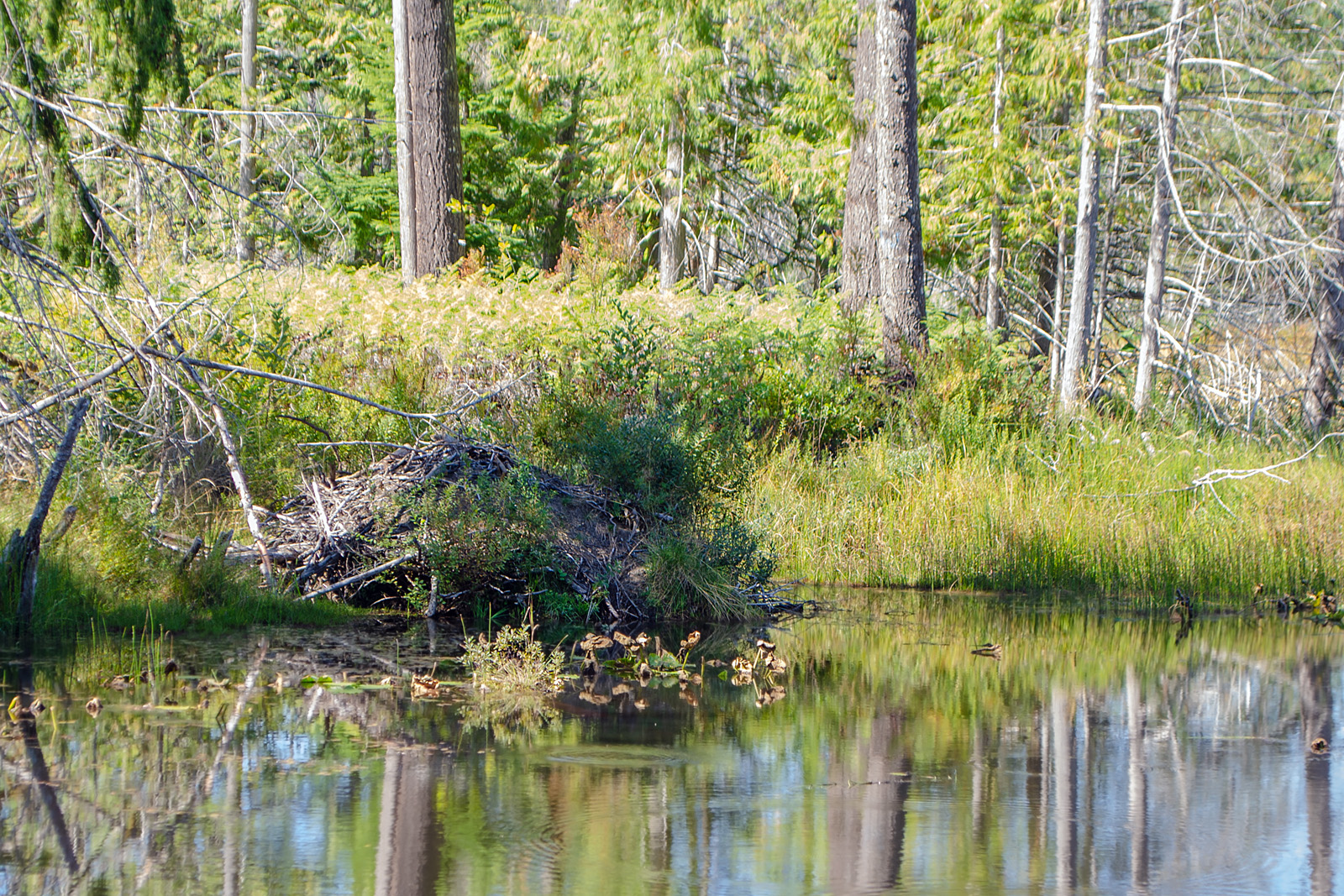
Various shots along the highway across the island last week, before the rain returned and closed the highway with a washed-out bridge; mist and frost and muted colours.

Highway 28. Frost highlights the tips of evergreen branches and roadside plants here. Mist hides the mountains beyond.

Under frost and mist, even logged-off, scraped hillsides can be beautiful.

Live evergreens, massed, create their own slightly warmer microclimate; exposed at the side of the road, isolated small plants and dead branches freeze.

An alder collects ice crystals while the evergreens shrug them off.

Viewpoint over Upper Campbell Lake. I have taken photos from this spot many times before, always in the winter months. The light is different every time. No frost here.

A Skywatch post.
~~~~~~~~~~~~

Y vuelve a llover. Parece que va a seguir lloviendo, por lo menos, por varias semanas. Las temperaturas, hasta bien al norte en Bella Coola, donde acostumbraba ver temperaturas de 20° bajo cero en esta temporada, son las de las primaveras. Hoy aquí en Campbell River están a 9°, y en Port Hardy cerca del extremo más al norte de la isla, a 10° (lloviendo, claro). Nuestro invierno, demasiado corto, ha terminado; estas serán las últimas vistas con hielo de este año. ¡Ni siquiera tuve que desempacar mis botas acolchadas! 

—Viéndolo desde el lado positivo, mis crocus y campanillas están a punto de producir sus flores, los Lamprocapnos (Corazon sangrante) ya han brotado; en los bosques, los huckleberry (Vaccinium parviflolium) tienen botoncitos rojos. —

Saqué estas fotos al lado de la carretera que cruza la isla hacia el oeste la semana pasada, antes de que  volvió a llover y el agua cerró la carretera, destruyendo un puente. Neblinas, escarcha, colores apagados.

  1. La carretera #28. Escarcha en las ramas expuestas al aire. Neblinas esconden las montañas.
  2. Cubiertos de escarcha, hasta los sitios que han sido destruidos por las máquinas de construcción de carreteras y por los madereros pueden ser hermosos.
  3. Donde los árboles coníferos crecen juntos, forman su microclima, un tantito menos helado; plantas expuestas por la carretera, especialmente árboles muertos, atraen la escarcha.
  4. Un aliso rojo se ha cubierto de hielo; las coníferas se mantienen libres.
  5. Vista sobre el lago Upper Campbell. He sacado fotos desde este punto muchas veces, siempre en invierno; la luz es distinta en cada foto.
Un post de Skywatch.

Friday, February 14, 2025

Creek, stopped in its tracks

Giant icicles pouring down a cliff face:

Through the windshield.

Through the open side window.

I took these photos from the car without stopping; the highway here along the shore of Upper Campbell Lake has no shoulder, and the curves make obstructing traffic perilous.

The ice melts, 'way up top, the water flows down the mountain side in small creeks around the roots of the forest, and then, dropping over cold rocks into the open air, instantly freezes again.

~~~~~~~~~~~~~

Carámbanos; un riachuelo congelado, cayendo sobre la faz de la roca. 

Estas fotos las saque con el coche en movimiento. La carretera en este rumbo, a lo largo de la orilla del lago Upper Campbell no tiene borde y las curvas frecuentes hacen impedir el tráfico de lo más peligroso.

El hielo allá arriba en la cima de la montaña se derrite, y el agua baja por entre las raices del bosque hasta llegar al aire libre y las rocas peladas y frias; allí se ha vuelto a congelar instantaneamente.

  1. Foto desde dentro del coche, por medio del parabrisas.
  2. Y mirando hacia el lado, con la ventana baja.

Monday, January 20, 2025

Cliff, non-conformist

This was strange. Unexpected and confusing.

The sun was shining; where you stood in its light, you could feel the gentle heat. Otherwise, along the edges of the lakes (Upper Campbell and Buttle) the temperature was near freezing. In spots, where the shadows hadn't seen sunshine all day, a light coating of frost or sometimes snow dusted the ground.

Along the upper end of Upper Campbell Lake and the bottom of Buttle Lake, the highway follows the east shore, heading almost directly south. This is an area of high, stony cliffs, facing west here; the afternoon sun hits them full on, even in winter.

One of these cliff faces, just one, was producing ice. It coated the vegetation in the shallow ditch beside the road. Above, the rock was clear, but wet; isolated drips fell onto the frozen plants below, probably from melting ice farther up. Moss and plants closer to the rock were untouched, ice-free. 

This was the only icy spot. It was in a bad spot for parking; the road was narrow, without a shoulder, and trucks could be expected to barrel around the curve at any moment. The nearest pullout was over a kilometre away in both directions. So I drove on, then back, then back again, looking for more ice. There was none, and I finally eased the car into a spot between guard posts, too close to the drop off for comfort, but it was the best I could manage.

And the icicles weren't following the rules. Some hung directly down, as gravity demands; but others hung at strange angles, up to a 30° angle off the vertical. Why?

See:

Ferns in ice. The moss is ice-free.

Ice-covered  branches.

Insane icicles.

Another fern. Ice coats one hanging vine; the others, on the right, are ice-free. Go figure.

Rose hips in ghostly shrouds.

And all the way to the middle of Buttle Lake, there was not a spot of ice on any of the rock faces. Or on the ground below them. Just on this one, with its own personal microclimate.

~~~~~~~~~~~

Esto era algo extraño, inesperado.

Era una tarde asoleada; se te detenías donde la luz del sol te llegaba, sentías un calor suave. Aparte de eso, en las orillas de los lagos Upper Campbell y Buttle, la temperatura andaba cerca de 0°C. En sitios en sombra, donde la luz no había tocado en todo el dia, el suelo llevaba una leve capa de nieve o de escarcha.

Desde el centro del lago Upper Campbell, hasta el centro del lago Buttle, la carretera sigue la orilla occidental, dirigiéndose hacia el sur. En este rumbo, el  agua llega hasta el pie de peñascos altos, con sus caras hacia el oeste; el sol de la tarde les pega directamente, aun en invierno.

Uno de estas pilas de piedra producía hielo. Uno solamente. El hielo cubría las hierbas que crecen en la zanjita al lado de la carretera. Arriba, la roca estaba mojada, pero sin hielo. De allí, gotitas aisladas de agua, probablemente producidas por hielo que se descongelaba, salpicaban las plantas congeladas. El musgo que cubre la faz de la roca, y algunas plantas más protegidas se quedaban sin hielo.

Este era el único lugar con hielo. Era un sitio no apropriado para estacionarme; la carretera es angosta, sin acotamiento, y en cualquier momento se podría esperar algún camión minero manejado a la máxima velocidad permitida. El primer sitio donde se había proveído un espacio para permitir el paso estaba a más de un kilómetro en ambas direcciones. Así que seguí adelante, di vuelta cuando pude, pasé por enfrente, y volví a pasar. Esto, sin ver hielo en ningún otro sitio. Por fin, me arrimé lo más que pude, estacionando el coche en el mero borde de la caída al agua. No muy seguro, pero, ni modo.

Y los carámbanos no obedecían las reglas. Algunos colgaban apuntando directamente hacia el suelo, como exige la gravedad, pero otros apuntaba en varias direcciones, hasta a unos 30° de lo vertical. ¿Porqué?

Fotos:

  1. Helechos cubiertos de hielo, y musgos sin hielo, en la faz de la roca.
  2. Ramitas completamente cubiertas.
  3. Carámbanos locos.
  4. Otro helecho. El hielo cubre por completo una de las ramas colgantes; otras, al lado derecho, quedaron completamente libres.
  5. Escaramujos (rojos) en sudarios de fantasmas.
Y en todo el camino, desde aquí hasta la mitad del lago Buttle, no hubo ni un solo pedazo de hielo en ninguna de las rocas. Solamente en este sitio, con su microclima muy personal.

Sunday, January 19, 2025

Where the road takes me

The sky was blue, that clear blue that we get on chilly days. The highway caught me; each curve unveiled a new work of art. I ended up on the shore of Buttle Lake, looking at cliff faces.

Along the way:

Nearly there. A straight stretch, for a change. Taken through the dusty windshield.

A narrow, sinuous bit of flat ground; that's the road. Everything else stands on end.

Trees on the cliffs, leaning in for protection from the wind.

Upper Campbell Lake. I've taken many photos from this spot; the light is different every time. The mountain in the centre is Elkhorn Mountain.

Ice photos next, I think.

A Skywatch post.

~~~~~~~~~~~~~
El cielo estaba azul, ese azul clarísimo que se ve cuando la temperatura anda cerca de 0 grados. La carretera me llamaba; cada curva revelaba un paisaje nuevo. Al fin, me encontré al lado del lago Buttle, mirando peñascos.
  1. Un tramo de carretera sin curvas. No hay muchos de estos. La foto la saqué por medio del parabrisas, lleno de polvo.
  2. Carretera normal: un hilo angosto de tierra plana serpenteando al pie de las peñas.
  3. Allá arriba, estos árboles se inclinan hacia la protección de la piedra.
  4. El lago Upper Campbell. He sacado muchas fotos desde este sitio; cada vez la luz es diferente. La montaña en el centro es Elkhorn.
Fotos de hielo luego.


Tuesday, December 14, 2021

Curvy

 A bend in the road.

This highway crossing the island coast to coast, wending its way along valleys and lake shores between soaring mountains, twists and turns like a lazy snake. The other day, in a 5 km. stretch of highway, I counted 20 sharp turns, ignoring the minor bends. Some of those curves are marked, some have speed limits; with others, well, you should have expected them anyhow.

Sometimes, driving along, swinging left, swinging right (good shoulder exercise), you pass a small sign: curves ahead. Well, really! I never would have guessed!

This curve, at Snakehead Lake, has arrows. Just in case you didn't notice the trees dead ahead.

~~~~~~~~~~~~~~~~~~~~~~~~~~

Una curva en la carretera.

Esta carretera que cruza la isla de costa a costa, buscando su camino entre los valles y bordeando los múltiples lagos a los pies de las montañas, se retuerce como si fuera una víbora sin prisas. El otro dia, en un tramo de 5 km. de la carretera, conté 20 curvas abruptas, sin fijarme en las leves. Algunas de estas vueltas vienen con señales o límites de velocidad; con las otras, pues debes haberlas esperado de todas maneras.

A veces, siguiendo el camino, vuelta para la izquierda, vuelta para la derecha (¡Es un buen ejercicio para los hombros!), veo un anuncio pequeño; Adelante Hay Curvas. ¿De veras? ¡No me lo habría imaginado!

La foto: esta curva, al extremo del lago Snakehead, tiene flechas. Por si no hubieras visto los árboles justo en frente. 

Tuesday, September 15, 2020

Myra Falls; third failed attempt

Highway 28 crosses the middle island, coast to coast, following the shores of the Upper Campbell lake, then the Gold River to the inlet at the end. Where it reaches the bottom of the Upper Campbell, it links to Westmin Road, which goes down one side of Buttle Lake, and dead ends at the Myra Falls mine. And just before the mine, there are two waterfalls that I wanted to see: the Upper and the Lower Myra Falls.

Google map view of the bottom of Buttle Lake, and Myra Creek.

But Buttle lake is a long, long lake, more like a wide river. 23 kilometres long, at most 1.5 wide. The road hugs the bank, along the edge of tall cliffs. Three times I've headed down that road, on my way to the falls; twice I gave up halfway, having "wasted" my time stopping to look at rock faces and their plants.

This past week, I finally made it to the end of the road.

Myra Falls is a roughly 200 foot tall series of plunges and punchbowl waterfalls found where Myra Creek empties into Buttle Lake in Strathcona Provincial Park on Vancouver Island. The falls are separated into three main sections with large pools in between. The uppermost consists of two drops in narrow gorge, the middle is three drops where the creek encounters a wide set of steps and the final two drops occur where the creek crashes directly into Buttle Lake. (World Waterfall Database)

First step, I think.

It was a hot, hot day, unusually hot for this climate. This is important; it sort of explains why I wimped out. As soon as I stepped out of the car at the parking lot, I felt dizzy, but the trail led down into the shade.

The path was steep, and seemed to go on and on, always steeply down. My old knees felt shaky. I asked a woman on her way up how far down it went; she waved vaguely off to the left. "Take the trail to the upper lookout. Don't go to the lower one," she said. Okay.

A side trail led to the upper lookout, ending in a narrow platform looking down into a green pool.

Green pool below the first step.

I  started back. From the trail, I could see people on the rocks below me, below the lower lookout. It looked inviting, but I had been warned. And it was hot, even in the shade. The heat was sapping my energy, killing my curiosity. I'm a cold-country woman.

Not quite the bottom; there's still a drop to the lake.

I trudged on up the trail, stopping to rest in the shade a few times. I was surprised when I came to the last curve; there was the sign at the entrance, just ahead, and I had made it easily!

I should have taken the lower trail. Back home, looking at the trail website, I followed a contour graph; the steep part of the trail was the one I had taken. The rest would have been easy. Now I know.

The creek cuts down through steep, tall cliffs.

So: another failed attempt. I'll have to go back, and walk down, down, down to the rocks at the entrance to the lake. And that's just the Lower Myra Falls. Another trail leads up into the hills to reach the Upper Myra Falls. It's over an hour's hike; someday, I must try it.

Map: I was here.

~~~~~~~~~~~~~~~~~
La carretera #28 cruza la isla por la mitad, desde Campbell River a Gold River. Sigue por la mayor parte, las orillas del lago Upper Campbell, y luego el rio hasta la costa. Pero al extremo del lago, un camino, el camino Westmin, sigue para el sur y el lago Buttle para terminar en la mina de Myra Creek. Y justo antes de esta mina, hay dos cataratas que quería visitar, la catarata superior Myra, y la inferior.

Pero el lago Buttle es un lago muy largo; casi parece más bien un río gordo. Tiene 23 kilómetros de largo, apenas 1.5 de ancho. Tres veces he atentado ir a las cataratas, y siempre me he detenido demasiado, mirando precipicios y rocas y las plantas que crecen en ese ambiente. Hasta la semana pasada, no había llegado ni al final del lago antes de tener que volver a casa.

La catarata inferior es una serie de 7 escalones, cayendo primero por un cañon angosto, luego extendiéndose y cayendo sobre rocas hasta llegar al lago 200 pies abajo del primer escalón.

Hacía calor. Mucho calor. Más de lo acostumbrado en este clima. Esto es importante para explicar lo que hice. En cuanto salí del coche en el estacionamiento, me sentí mareada. Pero el sendero se dirigía cuesta abajo, en sombra.

El sendero estaba muy inclinado y parecía seguir sin fin. Le pregunté a una mujer que venía subiendo, que cuanto faltaba para llegar. Apuntó vagamente hacia la izquierda, y me dijo que tomara el sendero para el puesto de observación superior. —No vayas hasta el puesto inferior— me dijo. Bueno.

El camino al puesto de observación me llevó a una plataforma pequeña que miraba hacia abajo a una charca verde. Este era el primer escalón de la catarata, creo.

En el camino de regreso, podía ver tras los árboles que había gente en las rocas abajo. Se veía atractivo, pero me habían advertido. no iba a intentar la bajada, especialmente porque hacía tanto calor. El calor me minaba la energía, me quitaba la curiosidad. Seguí cuesta arriba.

Y no era tanto como había creído; hubiera podido hacer toda la vuelta.  Me sorprendió cuando el sendero dió la última vuelta, y ahí en frente estaba el estacionamiento.

Bueno, ahora ya lo sé. Tendré que volver otra vez e ir hasta las rocas al pie de la última catarata.

Y todavía hay la otra catarata, la superior. Algún día seguiré ese sendero. Es un poco más largo, más difícil, pero valdrá la pena.

Thursday, August 27, 2020

At Cromers Corner

 Most of Vancouver Island terrain is standing on edge.

Roadside cliff face. The hill rises 100 metres here in a distance you could throw a stone across. And then goes on to rise some more behind the trees.

More vertical rocks.

And the view from the other side of the road. A steep drop to the lake.

Cromers Corner is not identified on any map. It's about halfway down Upper Campbell Lake.

And as you continue down the lake, the hills only get higher, the cliffs more vertical, the shoulders of the road narrower (or non-existent); every so often, there's a pullout, wherever the road builders could wrangle a bit of a flat spot, so that slower, more cautious drivers can allow others to pass. There are no passing lanes for most of the crossing of the island and the yellow line down the centre is solid; don't dare pass; visibility is only as far as the next curve, a few car lengths away.

The road curves and curves and curves again, following creeks and lakeshores. Driving it is a good shoulder workout.

I could drive this every day. I find it relaxing. Others' mileage may vary.


~~~~~~~~~~~~~~~~~~~~~~~~~~
El terreno en la Isla de Vancouver se dispone verticalmente por la mayor parte. Estas fotos muestran la vista desde un punto en la carretera a la mitad del lago Upper Campbell. Grandes fachadas de piedra, montando 100 metros en una distancia por el cual podrías aventar una piedra.

Mientras sigues la carretera hacia el oeste, los cerros se erigen más altos, los precipicios se imponen aun más, y la carretera se vuelve más angosta, casi sin bordes. De vez en cuando hay unos metros de tierra plana, donde los constructores del camino forjaron un lugar en donde puedas salir del camino y dejar pasar carros que tienen más prisa, o menos cuidado. No hay carriles para rebosar; la linea amarilla en el centro del camino es sólido. No te atrevas a pasar, cruzando esa linea; no se puede ver más adelante de la próxima curva, apenas distante unos cuantos metros.

El camino da vuelta y da vuelta y da vuelta de nuevo, siguiendo riachuelos y el borde del lago. Manejarlo es recibir un buen masaje de los hombros.

Yo podría manejar esta ruta todos los dias, con gusto. Me descansa. (No todo el mundo estará de acuerdo.)

Friday, August 07, 2020

The watcher in the rock

 Everywhere you go ...

They're watching you.


Cliff face, Upper Campbell Lake.


~~~~~~~~~~~~~~~~~~


A donde quiera que vayas, te están mirando. Rocas al lado del lago Upper Campbell. Con ojos.

Wednesday, July 01, 2020

Where the trail goes

And now the foxgloves are in bloom. In open spaces in the bush, along the highways, on lake shores; wherever the sunshine can reach.

I drove west, looking for a spot where I could get close to a patch. Once I was beyond the bustle of the city and the outlying businesses, gravel pits and the like, I looked for a stretch of highway with enough of a shoulder to get out of the way of trucks, far enough away from sharp curves for visibility (not so easy on the way west), away from deep forests, and with a shallow enough ditch for me to cross. And no blackberries in the ditch. Not an easy search.

Near Echo Lake, I found a suitable spot. And across the highway, a narrow path led off behind the trees.

The trail leads down the hill.

I often wonder about the little trails I find. Who makes them? Who goes from here, where there is nothing, to there, where there is just more bush?

The trail here was narrow, at times barely the width of a shoe. Not a bear trail; too narrow. Not a deer trail; it was too consistent, and there was no scat. Rabbits, maybe; where there was grass, it bent over the trail, making a tunnel. It had been used recently; some of the grass lay flat, and I saw a broken yarrow stalk, the flowers still fresh.

Humans, maybe a fisherman? But the trail meandered too much; uphill, then down, to the left, to the right. It finally led over the side of the hill, a steep climb, as I realized on the way back.

Tiny wild raspberries beside the trail. One has only one seed.

At the bottom of the hill, a gravel road skirted the lake.

Elk River Road.

I looked for it on Google maps later. The road leaves the highway on the far side of Echo Lake, passes a couple of campsites, then wanders east and south, almost randomly, for 17 km, until it ends up back on the outskirts of town. A logging road; there is nothing there but old logged-off forest, growing back. Side roads lead to clear patches, more recently logged.

On the far side of the road, the trail drops down through thick forest, and ends at the side of the lake. Mirror Lake, I learned from Google maps.

(The satellite view on Google maps is so good that I could even see the bush that the trail bends around before it drops to Elk River Road.)

And there were foxgloves.

Foxglove patch on the hillside above me.

And foxgloves beside Mirror Lake.

Foxgloves come in white, pink, and deep magenta.

On the way back to the highway, I picked a couple of handfuls of huckleberries. And then I came home.

~~~~~~~~~~~~~~~~~~~~~~~

Ahora las dedaleras (Digitalis purpurea) están en plena flor. Crecen donde hay sol, al lado de la carretera, en espacios abiertos en el bosque, al lado de laguitos.

Salí a buscarlas. Quería un sitio donde podría llegar cerca sin luchar contra moras o trepar en tierras movedizas. Tomé la carretera hacia el oeste, dejando atrás la ciudad y los sitios alrededor donde excavan grava, donde los camiones van y vienen. En la carretera, buscaba un sitio para estacionarme que tuviera suficiente espacio al lado del camino para no bloquear el paso, que no estuviera demasiado cerca de curvas donde no se puede ver lo que hay a la vuelta (algo difícil en esta carretera), donde el bosque no estuviera muy denso, donde la zanja no fuera muy honda, y donde no estuviera cubierta de moras. No era fácil de encontrar.

Cerca del lago Echo, encontré un sitio adecuado. Y al otro lado de la carretera, un caminito se dirigía atrás de los árboles.

Me intrigan estos caminitos. ¿Quién los hace? ¿Quién va desde un sitio sin nada hacia otro sitio que no es nada más que más bosque?

El caminito era angosto, a veces no más que el tamaño de mi pie. No era camino de osos: demasiado pequeño. Ni venados: ni había bolitas de venado, ni huellas, y el camino era demasiado consistente. Los venados brincan.

Tal vez lo hicieron unos conejitos. Donde había pasto, se doblaba para hacer un túnel del tamaño apropriado.

Y se había usado recientemente; pasé una planta de milenrama rota, con las flores todavía frescas.

¿Alguna persona? ¿Un pescador? Pero el caminito vagaba demasiado; iba para arriba, luego para abajo, hacia la izquierda, hacia la derecha ... Por fin bajó el cerro y llegó a otro camino, un camino de grava.

Lo busqué luego en las mapas Google; es un camino de madereros que da vueltas por el rumbo por unos 17 kilómetros hasta regresar al pueblo. Y aquí cruza por el lago Mirror (Lago Espejo).

El caminito baja hasta el borde del lago, y allí termina.

Y había dedaleras, en el cerro, y al borde del lago.

Las frutillas en la segunda foto son frambuesas silvestres. Muy pequeñas, no muy comunes.


Sunday, September 22, 2019

More beaver lore

When my granddaughter was little, I took her places; to the parks, on gentle hikes, sometimes up steepish hills. She ran ahead, and I followed as quickly as I could. Sometimes, I had to rescue her; not often.

These days, when she visits, I take her to my favourite places, sometimes up and down steep hills. And she still runs ahead. And I still follow her, but slowly, cautiously. She hasn't had to rescue me yet, though.

I took her to see the beaver pond.

The beaver lodge, as I have always seen it, from the side of the highway.

We went down the back trail, to look at the pond from the other side.

The water lilies are almost all dried and brown now. Good beaver food.

On the way back, she headed off, straight through the bush where I had sort of wished I dared go, to see the beaver lodge from the back side. I followed her, one careful step at a time until I reached her, standing on a rise, looking down on the lodge.

The lodge, from the back side. The beavers have made a sort of trail over the muddy back end.

After that, we had to hike up the road and scramble through the bush to the other end of the pond, to get another view. I didn't make it down the last hill, and looked for mushrooms while she took water-level photos. On the way back, we passed a gap in the trees that gave us a glimpse of a muddy bank. And it was full of beaver tracks!

Beaver tracks, going and coming. The heavy tail blurs many of the tracks as the beaver walks, but there are a few, in the left angle of the X of branches, that show the five strong toes. It looks like the beaver's trail heads into the bush just behind them.

The beaver's front paws are smaller, the rear ones are as big as my hands. The hind toes are webbed, but not the front ones.

Since beavers live near water, their tracks are often found in mud, which gives good detail to the prints. Beaver tracks show webbing on the hind feet. Hind tracks can easily be six to seven inches long. All feet have five toes. The prints show five toes on the hind feet and four toes on the front feet. The fifth front toe sometimes registers, but not on all surfaces. Front tracks can be two to three inches long. Claw marks show in the tracks. Beavers walk plantigrade, or flat-footed. The large tail sometimes leaves a drag mark in the trail. (https://www.bear-tracker.com/beaver.html)

Reading up on beavers, trying to confirm that these were, in fact, beaver tracks (but what else could they be, behind a beaver lodge?) I learned of a couple more features that I should be able to find in the area: scat, sometimes deposited on the edge of the pond, and scent mounds.

Beavers establish scent posts near their ponds. These are composed of a mound of mud, grass and sticks piled up into a dome-shaped mass. The beaver rubs castoreum on the mound. Some of these mounds can be huge, measuring a foot tall and three feet across.(Bear Tracker)

I think I know where to look for these. A project for next summer!

And I still haven't seen hide nor hair of a beaver here!


Wednesday, March 21, 2018

Beaver Lodge

Last fall, I discovered (but only by poring over dark photos) a beaver lodge near Echo Lake. I passed that way again this week, and the light was better. Besides, I now knew where to look. The beavers are still there.

I think it's bigger than it was last fall. Looks cozy.

I searched on Google maps and found the exact spot. On the street view, taken in September of 2011, the lodge is just visible.

Google street view from Hwy. 28. The lodge seems to be smaller than it is today.

I waited, but saw no sign of the beaver family this time. Other than their home, of course.

Wednesday, September 20, 2017

Packed with seeds.

I saw these seed pods beside the highway to the island's west coast.

Unidentified plant, bare-stemmed, about 1 metre tall.

The seed pods are about 1 inch long. The stems stood tall above the surrounding vegetation, salal and ferns, in open, logged-off land.

What are they? Do you know?

Update: They're Tiger lilies. Here's a photo of the seed pods, taken by a friend in 108 Mile House, and posted on E-Flora. She also has a photo of the individual seeds, shaken out of the pods, here.


Friday, December 09, 2016

River mist

On a cold winter's afternoon, as the highway winds down the valleys towards Gold River, the hidden creeks and the river lift steams and mists into the freezing air.

The mist leaves shining droplets on the trees.

The river is warmer than the air; as moisture lifted from the river meets the cold air, it forms a mist, which rises because of the relative warmth of this air.

In winter, here, a blue sky means cold, dry air. It's warmer when the clouds close in; then, the mists descend from above rather than rising from the valleys.


Monday, November 09, 2015

Mushroom sampler

November is a good month to look for mushrooms and other fungi in the temperate rain forest. Even when the sun shines, it's never warm enough to dry the ground, but the temperatures are still usually above freezing. Every time I stopped, crossing the island this Friday, I found mushrooms almost with every step I took, and even up the trunks of trees.

And they're not the mushrooms I'm used to, from the Bella Coola or the Lower Fraser valleys. Of 20 some-odd different species I found, I recognized two, a yellow witches' butter (edible), and an amanita (not). I'll be digging through mushroom books and the web for a few days, trying to identify the others.

Witches butter on an old, burnt stump, with cladonia lichens and mosses.

Amanita, probably muscaria. 

Generic 'shroom. These are hard to identify, because they're so similar to many others.

Really strange mushrooms. The cap seems to be melting, but I didn't see any completely deliquesced ones. And the stems are all twisty. These were growing in semi-tame land; beside the road at the Park entrance.

Very tiny, tall mushroom. The evergreen needles give an idea of the size.

More tomorrow, after I've done my homework.


Sunday, November 08, 2015

Almost full circle

In my earliest clear memory, I was standing on the dock in Tahsis, on the northwest coast of Vancouver Island. It was raining, just a drizzle. There was a boat; I think we had just landed. I was 4 years old.

A few days ago, checking maps and distances, I realized that I'm almost back where I started. There's a road through to Tahsis now, and it's less than a 3-hour drive from here. And the road is paved all the way to the west coast, at Gold River; after that it's gravel, and may be snowy going over two summits; they advise carrying chains in the winter.

So yesterday afternoon I headed west. I dawdled, stopping to take photos and look for mushrooms in the bush, so I only made it to the border of Strathcona Provincial Park, with 40 kilometres to go to Gold River, before I had to turn back to get home before night.

Coastal mountains, from the edge of Strathcona P. Park

Upper Campbell Lake. About 300 metres (1000 ft.) above sea level.

Three large lakes line up along valleys across the top of Vancouver Island, looking on the map like three wide rivers. First is Campbell Lake, in the hills just above Campbell River. It flows through a narrow neck into Upper Campbell Lake; the road follows the south side of the lake to the entrance to Buttle Lake; here it crosses and heads up the north side to the head of the valley going down into Gold River. I turned back just after the crossing.

Nameless islet at the west end of Upper Campbell Lake.

Spar tree in a logged-off area, with the new growth at its feet.

I'll post photos of some of the mushrooms I found tomorrow.

Powered By Blogger