Showing posts with label flooding. Show all posts

Tuesday, November 30, 2021

Waterfall #2

It's still raining. But they're reporting that the water level on Sumas Prairie has dropped about 6 inches, in spite of the rain. A smidgen of good news.

Here's another unnamed waterfall; at least this one falls into Buttle Lake, a lonely lake, and it pours under the road, not over it, flooding no farmlands, no houses. A friendly waterfall.

Tumbling down the mountain, from far above.

There's always a small pool at the bottom.

I stood there on the road, listening to the water; the spray was fresh on my cheeks and smelled of green, of cedars and firs, of wet rock.

~~~~~~~~~~~~~~~~~~~~~~~
Sigue lloviendo. Pero dicen que el agua ha bajado unos 15 cm. en el valle de Sumas. Un poco, un poquito de buenas noticias.

 Y aquí hay otra catarata sin nombre; pero esta cae hasta el lago Buttle, un lago solitario; y fluye por debajo de la carretera, en vez de por encima, y no inunda granjas ni casas.

Me detuve allí al pie de la catarata, escuchando la música del agua; el rocío se sentía fresco en mi cara, y olía a verdor, a cedros y abetos, a roca mojada.

Fotos:
La catarata cae desde muy arriba en la montaña, entre el bosque.
Y siempre hay un pocito en la base. 


Monday, November 29, 2021

The way it used to be

The water is rising again. Highways that had been reopened (at least to essential travel) are closed again. The rivers (Fraser, Nooksack, Vedder, Sumas, Chilliwack rivers) are pouring into Sumas Prairie. Again, on top of the flooding from two weeks ago. And more rain is coming.

I've been remembering my lazy drives across this area, coming home from points east, following the farm roads, jogging south and west, watching birds and cows and growing things; corn and pumpkins, flowers and fruit, nuts and veggies. All underwater now.

Somewhere in the valley, September 2013

Corn, 2010

Contented cows, under Vedder Mountain, 2010

Pumpkins ready for market, 2013

Today's news is full of photos of muddy, brown water, half-drowned barns, sandbags, and maps of evacuation zones.

Screenshot, CTV News.
So sad.

~~~~~~~~~~~~~~~~~~~~~~~~~

Se está subiendo el agua otra vez. Carreteras que se habían abierto, aunque solo para tránsito esencial, se han vuelto a cerrar. Los rios (el Fraser, el Nooksack, Vedder, Sumas, Chilliwack) se han desbordado y están cubriendo el valle de Sumas. Otra vez, sumándose al agua que todavía cubre las granjas desde las inundaciones de hace quince dias. Y nos amenaza otro río atmosférico.

Me he estado acordando de los dias cuando cruzaba este valle, descansando de regreso a viajes al este, siguiendo los caminos hacia el sur y hacia el oeste, entre los campos alegres llenos de pájaros y vacas y plantas, maiz y calabazas, flores y frutas, nueces y verduras.

Todo está bajo el agua ahora.

Fotos:
  1. Una granja, septiembre de 2013
  2. Maiz, 2010
  3. Vacas en la sombra del monte Vedder, 2010
  4. Calabazas listas para el mercado, 2013
  5. Captura de pantalla, hoy, CTVNews
Las fotos en las noticias de hoy son de agua llena de lodo, graneros inundados, sacos de arena, y mapas de zonas de evacuaciones.

¡Tanta tristeza!

Sunday, November 21, 2021

I'm back

I'm sorry; I've been so disheartened by the drowning and destruction of our highways and farms and homes, even though where I am, it doesn't touch me directly for now, that I have not been able to look at my cheerful photos, some taken while the water elsewhere was busy creating havoc.

I started blogging, so many years ago now, celebrating the life and beauty all around us. So much to see, underfoot, underwater, in the air above us, in the forests and fields; so much to rejoice in!

But increasingly, I find I'm documenting the losses. The starfish died. We've been clearcutting our forests, destroying habitat for bears and bees and birds. Invasive plants crowd out the deer's fodder. I rarely see moths these days; walking down forest trails, I no longer find myself walking into spider webs. After this summer's heat dome, the beaches smelled of rotting mussels, not able to survive the baking sun at low tide. 

We have fouled our nest; it's about time we started to clean it up.

And this flooding, these landslides and washouts, are part of the picture. Clearcutting destabilizes slopes; dead wood encourages fires; roots no longer hold back the water. And it comes rushing down the hillsides, ripping out our roads and homes as it comes.

This isn't the end of sorrows; while we continue as if nature were indestructible, more torrential rains will fall, more snow will melt, more animals will die.

I am still disheartened.

But we must go on. Even if it's just recording what is and soon may not be.

So here's a beaver pond and lodge, surviving the high water.

The beavers have built their lodge tall, so they still have a dry sleeping space.

The back side of the pond. The water has covered the usual crop of waterlilies and reeds. The birds are too far away to be identified.

~~~~~~~~~~~~~~~~~~~~~~~~~~~~
Lo siento: he estado tan desanimada por lo de las inundaciones y derrumbes, donde se ahogan nuestros hogares y campos y se destruyeron nuestras carreteras principales; aunque por ahora, donde vivo, no me ha afectado directamente; que no he podido ni mirar mis fotos, demasiado alegres, algunas sacadas mientras que el agua en otras partes de la provincia causaban catastrofes.

Empecé a escribir el blog, hace ya muchos años, para celebrar la vida y la belleza que nos rodea. ¡Tanto hay que ver, bajo nuestros pies, en el agua, el los bosques y los campos, en el aire donde vuelan las águilas; tanta razón de regocijarnos!

Pero cada vez más, me doy cuenta que estoy contando las pérdidas. Las estrellas de mar se murieron, por miles, millones. Hemos estado tumbando nuestros bosques, dejando la tierra desnuda, destrozando los hogares de los osos, los alces, los pájaros y todo. Plantas invasivas no comestibles crecen donde antes los venados encontraban alimento. Casi nunca veo mariposas nocturnas en estos dias; caminando por los senderos del bosque, ya no me doy con la cara en las telarañas. Después del calorón de este verano, las playas apestaban a mejillones podridos, que no pudieron aguantar el sol durante la marea baja.

Nos hemos destrozado nuestro nido. Ya era tiempo de que nos pusiéramos a limpiarlo.

Y estas inundaciones, los corrimientos de terreno, los torrentes que se llevan las casas y caminos, forman parte del mismo imagen. Cortando los bosques al ras desestabiliza las laderas de las montañas; la madera muerta, dejada tras las máquinas, se prende facilmente; incendios forestales destruyen las raices que detienen el agua. Y ahí viene ese agua, llevando la tierra con ella, destrozando nuestras casas y construcciones en camino.

Este no es el fin de problemas: mientra sigamos como si nada, como si la naturaleza fuera algo indestructible, seguirá lloviendo en cantidades inesperadas, se derretirá más de la nieve de las cimas, se morirán más animales.

Sigo desanimada.

Pero la vida sigue. Tenemos que marchar adelante. Aunque no solo sea para documentar lo que hay, y que tal vez luego no haya.

Así que aquí hay una laguna con madriguera de castor, y el agua a su máximo. (Por ahora.)

Fotos: la madriguera es grande; todavía hay lugar adentro fuera del agua. En la laguna, el agua ha cubierto todos los lirios acuáticas y cañas que normalmente cubren la superficie. Los pajaritos están demasiado lejos para poderlos identificar.


Tuesday, November 16, 2021

Underwater

So southwestern BC is now basically a pair of large islands: Vancouver Island, and what we've been calling the mainland, now cut off from the rest of Canada and northern BC. Our main highways going north and east are either underwater or completely destroyed, with no hope of repair for the rest of the year. At least. The railway is closed.

The Fraser Valley is flooded. Merritt is no more. Cows are being towed to safely from small boats. People are stranded between landslides. Houses are floating down the rivers. Dikes have given way. Evacuations continue.

Climate change is upon us, and we weren't prepared.

I am north of the affected area. Today the sun shone brightly, the roads were clear. I felt guilty, as if I should be suffering with the rest of the area.

I'll save my cheerful photos for tomorrow.

~~~~~~~~~~~~~~~~~~~~~~

Parece que todo el sur y oeste de la provincia se ha convertido en islas. Está la isla de Vancouver, donde yo estoy, y lo que hemos llamado hasta ahora, tierra firma; ya no funciona ese nombre. Estamos ahora aislados del resto del pais, e incluso del norte de la provincia. Las carreteras principales hacia el este y hacia el norte o están bajo el agua, o han sido completamente destruidas, sin esperanzas de estar abiertas en lo que resta del año, tal vez ni en la primavera siguiente. El ferrocarril está fuera de servicio por los derrumbes.

El valle del rio Fraser, donde vive la mayoría de la población, está inundada. La ciudad de Merritt ha desaparecido. En el valle, rescatan vacas, llevándolas atadas con cuerdas, nadando atrás de barcos. Gente, familias, están atrapados en sus coches, sin poder salir por los derrumbes adelante y atrás. Casas van flotando rio abajo. Los diques se han reventado. Siguen evacuando centros de población inundados.

Nos agarró el cambio climático y no estábamos preparados.

Yo estoy un poco al norte del area afectada. Hoy salió el sol; ni siquiera había nubes. Los caminos están secas y enteras. Yo me sentí algo mal, como si fuera culpable de no sufrir con los demás.

Guardo mis fotos, demasiado alegres, para mañana.

Thursday, July 19, 2012

Water lovers

The water was high in the Fraser River a couple of weeks ago, with some flooding in spots. The Coquitlam River flows into it, just a few metres down river from Colony Farm, which is all low-lying flood plain. When the Fraser floods, the water backs up here.At the exit from the parking lot beside the Kwikwetlem First Nations reserve (IR#1), we found a barricade and sign at our usual trail entrance: Flooded: Do Not Enter. It didn't look flooded; the path, at least, was dry. And while we wondered, a woman came around the bend from the "flooded" area. We asked her about it. "It's fine," she said, adding that the sign should have been taken down.

So we ignored the sign and headed down the trail. After a few bends, there were some muddy spots. And when I stepped, instead, into the grass, I found inch-deep water underneath.

We went on. A few more curves, and the muddy patches became puddles that eventually covered the whole path, inch-deep over stinky mud. Not exactly fine; we were glad to come to the bridge up to the dikes.

High water on the Coquitlam. The square box is a pumphouse.

Standing above the river, we could see that the water was still high, but had been higher; there was a grey layer of scum about 2 feet deep over the stems of the shrubs. And jammed up against the pilings, was a collection of debris and displaced pondweed.

Potamogeton natans, floating-leaved pondweed. The leaves come in two forms; those long, stringy things are the non-floating ones.

Leaves, detritus, and flowers. The flowers are inconspicuous, greenish yellow, and clustered on an erect stalk.

These plants are normally found in standing water, as in sloughs or ponds. The flooding, minor as it was, must have flushed them out of the old drainage ditches.


Beside the ditches, red elderberry is ripe for the picking.

Birds love these seedy fruits. They are edible for humans, but only cooked, and not especially palatable, although they are reputed to make good jams and jellies. Long ago, they were a staple food for native peoples.

But birds do love them. Even chickens; when my daughter had a couple dozen, I used to harvest the berries for them, for the fun of seeing them chase madly all over the place, trying to steal each others' treats.

Orange elderberries. I have never seen these before.

Black hawthorn, the native hawthorn. It is found often on old farm sites, especially along streams.

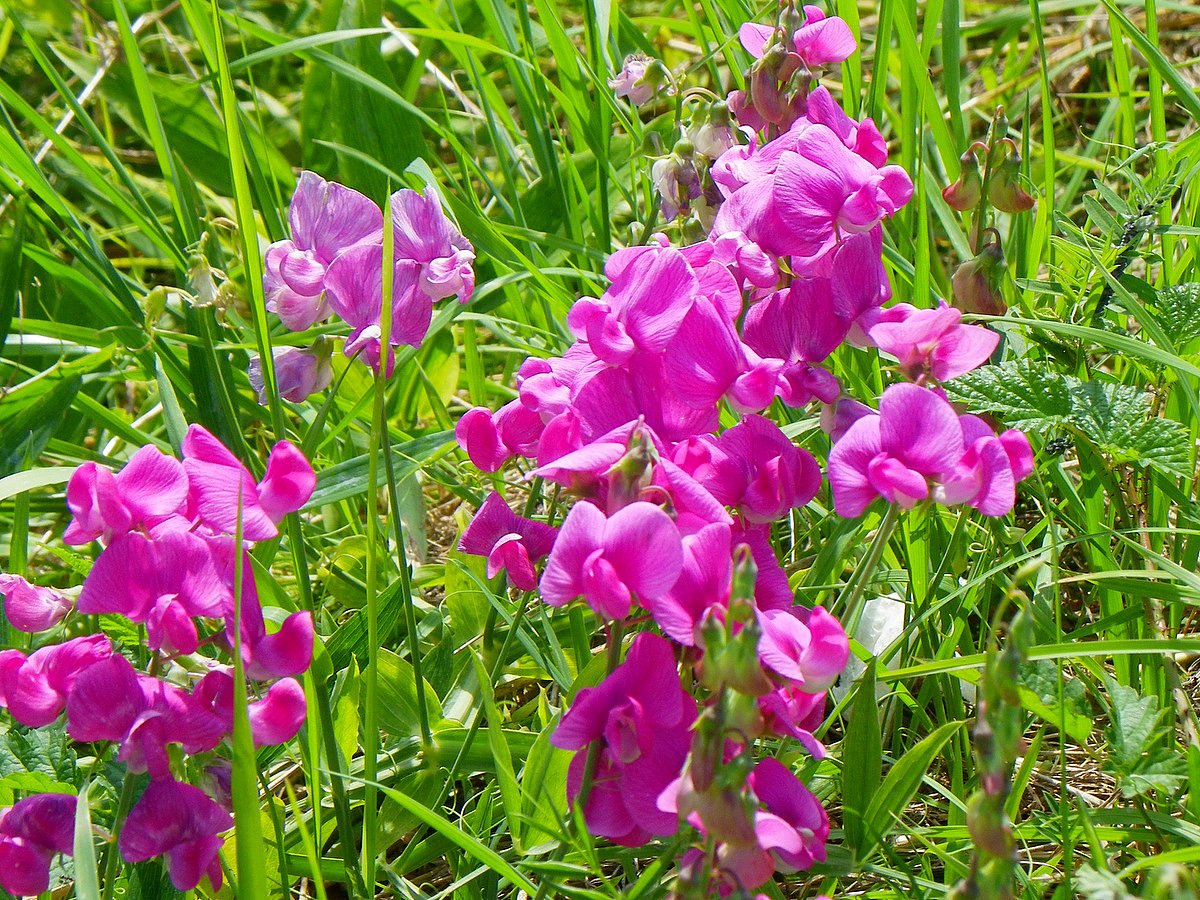
At this time of year, it seems that the dominant colour for flowers is pink, from native hardhack (alongside the river in the top photo) and lathyrus to stunning invasives:

A lathryus, probably purple peavine.

The noxious Policeman's helmet, Impatiens glandulifera. Notice the glowing seed pods.

A pale pink and white variety.

This plant is an escapee from gardens, and has become a worrisome invader. It grows up to ten feet tall, along streams or riversides. (Along the trail at the edge of Burns Bog, they stand with their feet in the shallow creek.) They overshadow native plants, starving them of light and nutrition, and will eventually drive them out altogether.

And those gorgeous seed pods are explosive. When they are ripe, the merest touch will make them pop open and eject the seeds, all 800 of them, up to 20 feet away. The seeds will sprout in soil or even underwater, and can survive up to 2 years, until conditions are right. Ripped out stems will sprout if left on the ground.

Bindweed buds

These are probably the introduced Hedge bindweed, Convovulvus sepium, which likes moist areas, and climbs over other plants more than the native field bindweed.

Bindweed tying up a sheaf of grasses.

Bindweed varies from dazzling white to blush pink.

Under a stand of taller trees at the edge of the reserve, we found an interesting variegated maple.

Two-tone leaf, striped snail

No two alike.
The afternoon was hot, hot, hot. We were sunburned in spite of sunscreen and hats. But our feet were dry again by the time we got back to the car.

Powered By Blogger