Showing posts with label Jagged Mountain. Show all posts

Sunday, June 14, 2026

Way points

Photos along the way ... Shots taken almost at tandom as I went north looking at flowers. In chronological order, starting just after 3 PM, an hour out of town.

Somewhere along the highway. I had stopped to look at lupins.

A disused logging road near Eve River. There were roses and thimbleberries here.

A trail down to Hoomak Lake. The sign reads, "Caution. Watch for overhead hazards. Do not use in windy conditions."

Hoomak Lake; the lakeside trail. Twinflowers and salal here.

A glimpse of Hoomak Lake. Hardhack, not in flower yet; the visible flower head is leftover from last year.

Sit and rest awhile.

Bottom of the staircase back to the Rest Area. Thimbleberry flowers here.

On the way home again. That's Jagged Mountain ahead. The Wikipedia photo was taken from this same spot, before all the alders filled the vacant space.

I guess this could count as a Skywatch post.

~~~~~~~~~~~~~~~~~

Algunas fotos del camino hacia el norte, mientras iba buscando flores. Están en orden cronológico; unas pocas horas, empezando cerca de las 3 de la tarde. (Salí de casa a las 2.)

  1. Al lado de la carretera, donde me había detenido para mirar unos lupinos.
  2. Un camino de forasteros en desuso. Aquí había rosas silvestres y flores de thimbleberry, Rubus parviflorus.
  3. Bajando por un sendero hacia el lago Hoomak. El aviso lee: "Cuidado. Estén conscientes de peligros en la copa del bosque. No usar (el sendero) en condiciones de viento."
  4. El sendero abajo, a la orilla del lago. Aquí hay flores gemelas y flores de salal, Gualtheria shallon.
  5. Una vista del lago. Las flores de hardhack, Spiraea douglasii, no salen todavía; las que se ven son las del año pasado.
  6. Siéntate y descansa un rato.
  7. Parte de la escalera que nos regresa al area de descanso. Aquí se ven las flores blancas de thimbleberry.
  8. Ya en camino de regreso, me detuve para mirar esas montañas. La del centro es Jagged Mountain (Montaña Accidentada o Irregular). La foto que se ve en Wikipedia  la sacaron de este mismo sitio, pero antes de que crecieran los alisos para llenar el espacio abierto.
Un post para Skywatch, donde se ven los cielos alrededor del mundo en esta semana.

Wednesday, December 08, 2021

View from the road

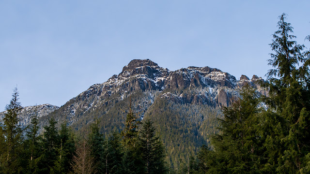
 A light dusting of snow. Mountain tops, from the roadside by the site of the ice flowers.
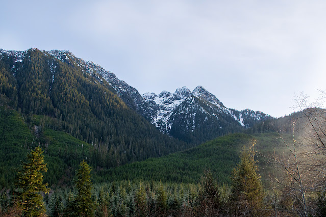
Facing south, with the sun heading down in the west.

And from the same spot, with my back to the sun.

December 3, at 3 PM.

I always want to know what mountains I'm looking at. Difficult, with so many peaks on this crumpled island, so many of them without names on the maps. "Driving" my mouse down the highway on Google maps, I found the spot where I took these photos. It looks different on Google; the trees were still in place back then. But I found the creek that cuts under the highway, and the flat spot I parked on. The highway there follows the bottom of the valley between Tsitika Peak and Jagged Mountain.
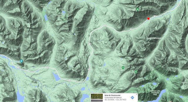
Google maps, terrain view.

~~~~~~~~~~~~~~~~~~~~
Un poco de nieve en las montañas, visto desde donde encontré las "flores de hielo".

  1. Mirando hacia el sur.
  2. Y con el sol a mis espaldas.
Esto fue el 3 de diciembre, a las 3 de la tarde. El sol se puso ese dia a las 4:15.

Siempre quiero saber como se llaman las montañas que veo. Algo difícil, con tantas montañas en esta isla toda arrugada, y tantas sin nombre en los mapas. Pero "manejando" por la carretera en Google, encontré el sitio en donde saqué estas fotos. Se ve diferente en Google; cuando ellos sacaron fotos, todavía no habían cortado los árboles. Pero hallé el riachuelo que cruza debajo de la carretera, y el sitio plano donde me pude estacionar. La carretera allí sigue el fondo del valle entre la cima Tsitika y la Montaña Jagged (Escarpada).


Powered By Blogger