I look at a beach and I wonder. What shaped it like this? How? And how long did it take?
Sometimes there are answers. Sometimes (usually?) they include words like "maybe", "possibly", "it has been suggested".
Wind, water, ice, (moving or still). Gravity, friction, chemistry, heat, life. And time, lots of time. Or not.
These are photos from one hour on one small stretch of beach.
 |
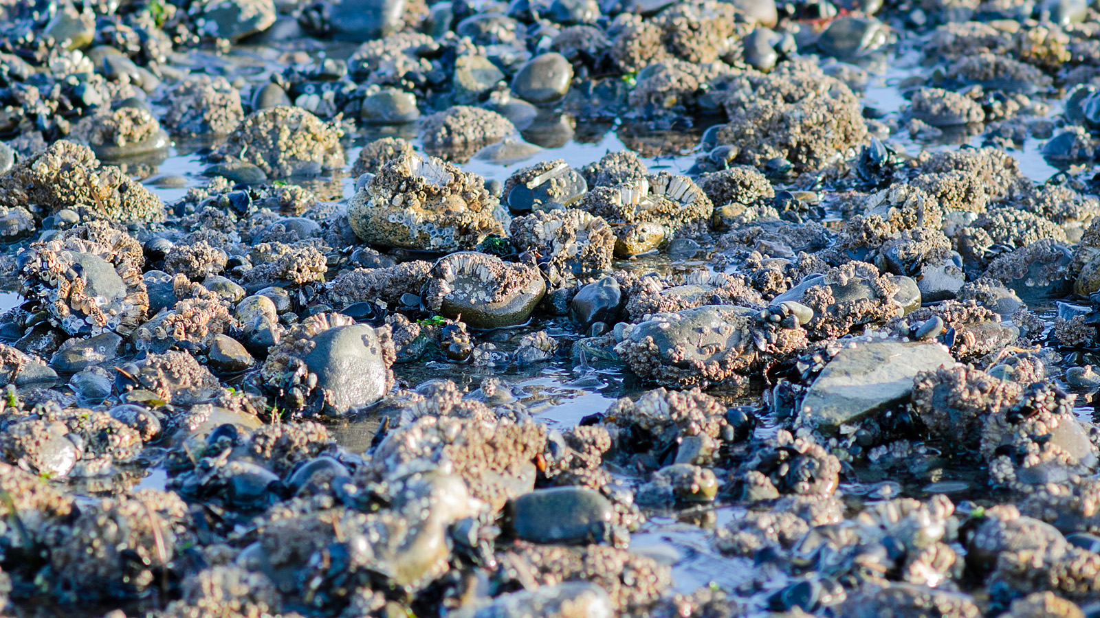
| At the bottom of the intertidal zone. Soft rock, shaped by waves, currents, colonized by barnacles and oysters.The tip is probably exposed at high tide. This rock is marked on the boating map, labelled "awash rock". |
 |
| Glacial erratics. Oysters, barnacles, seaweeds. Quadra Island in the background. The current in this channel runs fast and strong and sometimes chaotic. |
 |
| Wide stripes, running out to the water: rocks, then flat stone or sand, then rocks, then ... |
 |
| Upper beach, almost flat. Water draining from pools around rocks as the tide goes out carves lines in the sand. (Land to the right here, ocean to the left.) |
 |
| A bit higher up. The tide is far out, and the sand is almost dry, but water still trickles down from the land above the tidal zone, seeping through the sand. |
Miro una playa y me pregunto: ¿Qué le dió esta configuración? ¿Cómo? ¿Y cuánto tiempo fue necesario?
A veces hay respuestas. A veces —¿Casi siempre? — las respuestas incluyen palabras como "tal vez", "posiblemente", "se ha sugerido".
El viento, el agua, hielo, tranquilos o en movimiento. La gravedad, la química, la fricción, las temperaturas, la vida. Y tiempo. Mucho tiempo. O no.
estas son fotos que saqué en un tramo pequeño de playa.
- Donde termina la zona intermareal. Rocas suaves, esculpidas por las olas, las corrientes, y colonizadas por bálanos y ostiones. La cima probablemente sigue descubierta con la marea alta. Esta roca está señalada en el mapa para navegantes.
- Bloques erráticos, dejados por los glaciares. Ostiones, bálanos, algas marinas. Al otro lado del estrecho se ve la isla Quadra. La corriente en este sitio corre rápido y fuertemente, a veces en forma caótica.
- Franjas amplias, corriendo en dirección hacia el agua. Piedras, luego roca aplanada o arena, luego rocas, luego ... se repite.
- En la zona superior de la playa, casi horizontal. Agua que drena desde pozas alrededor de las rocas al salir la marea dibuja lineas en la arena. (Tierra firma queda a la derecha.)
- Esto está en la parte más alta de la zona intermareal. La marea ha dejado casi seca la arena, pero agua sigue escurriendo, bajando de la tierra firma.