Yesterday, before I posted
two photos of False Creek, I looked up a post from a year before, with some history of the area, and discovered that Blogger had lost it. And worse; I hadn't kept a copy. It wasn't even in the Google cache. With help from the Blogger staff, I found a copy on Google Reader, so I'm reposting it.
The photographs were taken a year ago; visitors to False Creek this year may find raptors in those snags, and other improvements.
*********
When Captain George Vancouver first mapped our Vancouver area shoreline, in 1792, he drew what is now the downtown area and Stanley Park as an island. The south bank was separated from the mainland by a narrow inlet. Along its shores and plying its waters, the Squamish, Musqueam, and Tsleil-Waututh nations spent their winters.
Half a century later, another George, G. H. Richards, captain of a British survey ship, sounded the channel, discovering that it soon petered out into sandbars, tideflats and sloughs, so shallow that canoes scraped bottom at low tide. He gave it the name of False Creek.
The native peoples were wise in their choice of seasons. In the summers, False Creek was a smelly mud flat, a "mosquito-infested swamp", an "eyesore", a "filthy ditch", according to developers and politicians over the next century. Various proposals for its use were tabled and discarded: filling it in completely and running the railroad over it, dredging it to create a harbour, filling the inner end for a railway terminus. At the end of the 19th century, a railway trestle bridge was built at the western end, ending in Kitsilano. In 1908, a bridge went up close to the eastern end, on what is now Main Street. It had a lifting span, intended to allow large ships to enter the "basin". (That shallow, canoe-grounding mud flat. The planners were optimistic!)
In the end, in 1913, the eastern end was filled in and deeded to the Canadian Northern Railway for their terminus. The rest stumbled along, home, variously, to tent cities, squatters, sawmills, shipbuilders, other industry, wasteland, sewer outlets and dump sites. The channel gradually narrowed, the banks encroaching on the open water. One of the sandbars was built up for docks and industrial uses, and named Industrial Island. (Modern users know it as Granville Island, a place to spend a happy hour or three browsing through artists studios, shops and a thriving market.)
I remember it from the 1980s: a noisy, grimy, crumbling jumble of ruins and warehouses. Strathcona residents had already begun their reclamation work at the eastern end, building community gardens; I blogged about this three years ago. (
Greening the dump, and
Cornucopia)
From the late 1960s through the '80s, the city worked on cleaning up and developing the north and east ends of False Creek.
Expo '86 showcased its possiblities. Residential developments were suggested for the southern banks, but I saw no progress until recently. The last time I walked through the area, about a year ago, all the walkways were fenced and surrounded (sometimes roofed) by messes of gravel and construction materials.
The other day, we walked from my daughter's house in Strathcona to the foot of the Cambie bridge, about half the length of False Creek. Look at it now!
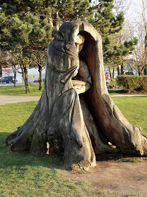 |
| In Creekside Park, three stumps with heartwood residents remember past days. |
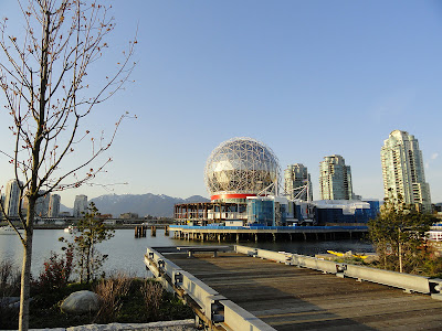 |
| From the southern bank, the old Science World "golf ball". |
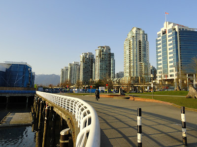 |
| A row of new buildings looks west. |
From here on, all this is so new it doesn't even show up on
Google satellite view yet.
 |
| A large open plaza between housing developments. Looking north, towards the Creek. Notice the sparrows? |
 |
| One of the birds. |
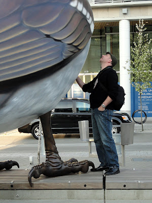 |
| Big bird. |
 |
| Very big. |
Half-way between Main Street and the Cambie bridge, the city is rebuilding a section of natural shoreline and wildlife habitat.
 |
| Park, with the makings of a waterway. Boards and grids (underwater) support the banks and retain native plants until their roots take hold. |
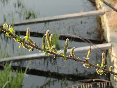 |
| Catkins and new leaves, over the edge of the waterway. |
 |
| Bringing back Birds, Brush and Barnacles: the new/old island. |
 |
| Looking across the island to the north bank, with the de-roofed stadium like a broken umbrella. |
 |
| The north end of the Cambie bridge from the island. |
 |
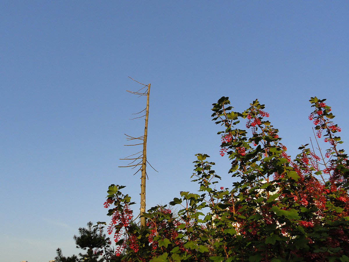
| Three tall, bare trees encourage raptors. |
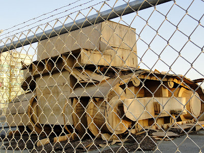 |
| Next along our route: a fenced area where Emily Carr University of Art & Design presented a project. They left behind this home-made "compost bin". |
 |
| The remains of some old-timer's dock, with telephone-booth sized shed. |
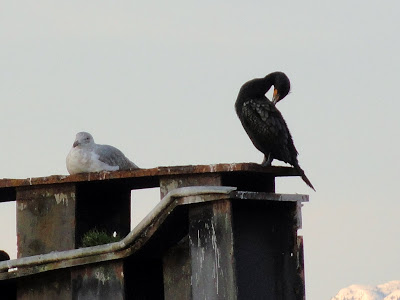 |
| And in the middle of the channel, a cormorant shares old pilings with a gull. |
 |
| With the last rays of sunlight, we arrived at our destination, at the foot of the Cambie bridge; Cavalia. Well worth the walk! |
For more info on False Creek, here are a few interesting sources:


I really love those huge sparrows!
ReplyDelete