In December, in deep snow, I stood on a bridge crossing the Quinsam River, and took photos of beaver tracks. I decided I would go back in the summer to look for a beaver lodge. Well, summer's still a way off, but I'm glad I went back now, while the trees and understory are just bare twigs.
I found a small mound that will be hidden again once the salmonberries that top it leaf out, right where the tracks had entered a hole beside the bank. Is it a lodge?
 |
| A small lodge. Or is it that the water's high? |
 |
| As seen in December. With beaver tracks. |
I walked to the far end of the bridge and looked down. Yes, the beavers have been here, and have been busy. No wonder the water looked high!
 |
| Dam loaded with fresh sticks. |
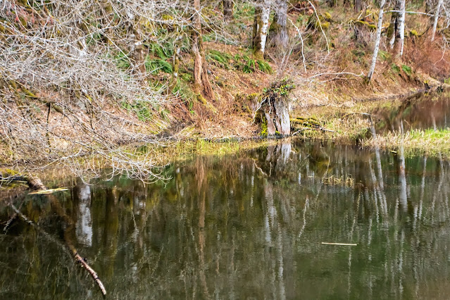
The road skirts Echo Lake and a couple of smaller lakes, then finds and crosses the Quinsam River, veers off southeast while the river twists and turns, snaking (a very curvy snake) its way north to join the Campbell River. I followed the road, looking for skunk cabbages. On either side much of the forest, where the land is flat, was underwater. Trees stand with their feet in the water; many have died and stand, shedding crumbling bark. Looks like beaver country, with every little creek dammed.
I started wondering; how many beavers live in an area like this? How many does it support? Back home, I looked it up. A beaver lodge, with its 2 to 10 beavers, claims one to three kms. of creek or shore. (Beaver: BC gov. publication)This area, (the road crossing it covers 11 km.) with many creeks, all tied in knots, probably can house several colonies.
 |
| Beaver country. From the second bridge, crossing a creek, not the Quinsam River. |
Another BC government document, this one from 1979, estimates the number of beavers on Vancouver Island at 12 to 18 thousand, which would work out at 1.7 beavers per square km. of the island or one average colony per 3 sq. kms. (The island covers 31,285 sq. km.).
That was a while ago, and much of the island has been logged off since then, so the numbers will be less. Or maybe not; what's gone is the evergreen cover, and the alders, prime beaver food, have spread out. A NatureServeExplorer page gives an estimate of a short-term increase rate at >10%.
And I still haven't seen even one beaver!
~~~~~~~~~~~~~~
En diciembre del año pasado, cuando la nieve cubría todo, me detuve en un puente que cruza el rio Quinsam, sacando fotos de huellas de castor. Decidí regresar en el verano para buscar la madriguera. Por suerte, fui ahora, cuando los arbustos y árboles desnudos no la esconden.
Encontré un montecito, abierto a la vista ahora, lo que no va a estar una vez que los arbustos de salmonberry se cubran de hojas.
Foto: El montecito, bajo un tronco, visto desde el puente. ¿Será la madriguera?
Foto #2: Lo que vi en diciembre. El mismo sitio, con huellas de castor.
Foto #3: Crucé al otro lado del puente y miré para abajo. Hay una presa, cubierta de palos nuevos. Sí, los castores han estado aquí y bastante activos, además. Con razón el rio me parecía más ancho.
El camino bordea el lago Echo y un par de lagunas, luego cruza el rio Quinsam, y se dobla hacia el sudeste mientras que el rio se retuerce y se enrosca, llegando últimamente a verterse en el rio Campbell. Yo seguí por el camino, buscando linternas de pantano. De ambos lados del camino, donde el terreno es plano, mucho del bosque estaba inundado. Los árboles tienen las raices en el agua; muchos han muerto y se quedan parados, mientras su corteza se desbarata lentamente. Parece terreno favorito de castores, con cada pequeño riachuelo bloqueado por sus presas.
Me puse a pensar: ¿Cuántos castores viven en un area como esta? ¿Cuántos puede sostener? Ya en casa, busqué la respuesta. Una madriguera, con sus habitantes, de 2 a 10, se consideran dueños de 1 a 3 kilómetros cuadrados de margen del rio o laguna. (Según este documento del gobierno de BC) Esta area, — el camino que la cruza mide 11 km. — con muchos riachuelos, todos enmarañados, probablemente puede sostener varias colonias.
Foto #4: Terreno ideal para castores. Desde el puente que cruza otro riachuelo.
Otro documento del gobierno, este fechado en 1979, calcula el número de castores en la isla de Vancouver en de 12 a 18 mil, lo que resultaría en 1.7 castores por cada km², o una colonia promedio en cada 3 km². (La isla cubre 321.285 km².)
Eso hace algún tiempo, y desde entonces han talado muchos de nuestros bosques, así que los números podrían ser menos. O tal vez no: lo que se ha perdido son los árboles de hoja perenne, y los alisos, que son buena comida para los castores, han multiplicado. Una página de NatureServeExplorer calcula el aumento en plazo corto de más de 10%.
¡Y sigo sin ver ni un solo castorcito!

No comments:
Post a Comment
I'm having to moderate all comments because Blogger seems to have a problem notifying me. Sorry about that. I will review them several times daily, though, until this issue is fixed.
Also, I have word verification on, because I found out that not only do I get spam without it, but it gets passed on to anyone commenting in that thread. Not cool!