Showing posts with label Canyonview trail. Show all posts

Wednesday, November 19, 2025

All wet

The Campbell River is a short one, as rivers go; barely 6 km. as the crow flies from where it drains out of John Hart lake to where it reaches salt water beside Baikie Island. From above the three falls (Moose, Deer, and Elk) starting at 150 m. above sea level,  it tumbles down a narrow gorge between rocky cliffs for half its length. Then the walls fall back and expose a small flat space, about 1/3 of a kilometre across, at around 11 m. above sea level. Here the main body of the river keeps rushing on down to the sea, but some of the water finds openings to the flats, and wanders in, gets lost among the hummocks and the fallen trees and up-turned roots. Some of the water keeps moving and rejoins the river downstream, some gives up and soaks into the mud.

It's always wet down there under the trees, even in mid-summer. At this time of year, after a few weeks of rain, there's not a dry twig to be found, not a dry stone to sit on. A couple of trails loop the area; I took the longer route the other day, since a good bit of the short loop was underwater.

So: watery pics.

A drenched log in the stream, with red-belted conks and fallen leaves. (See video below.)

Another soaked log, this one with a gull.

The deciduous leaves overhead are gone, but in the understory, salmonberry and thimbleberry shrubs are just starting to drop theirs. 

Old upturned roots make mini-islands in the streams. View of a bridge from a bridge on a second trail.

Near the inner edge of the flats, the land rises, leaves an open space for wetland grasses.

Even now, there's a hint of pink at the tops of the alders; catkins getting ready for spring. Here's where my trail went underwater.

The ferns will stay green all winter.

Even the mushrooms hold their tiny pools.

On the bank of a slow-moving stream.


~~~~~~~~~~~~

El Rio Campbell es corto, apenas logrando ser un rio; corre apenas 6 km., midiendo en linea recta, desde donde sale del lago John Hart hasta donde llega al agua salada pasando la isla Baikie. Desde arriba de las tres cataratas, (Moose, Deer, Elk) empezando a 150 m. sobre el nivel del mar, cae entre paredes rocosas por un desfiladero angosto por unos 3 km. Y luego, las paredes se abren, dejando un pequeño sitio aplanado, aproximadamente de 35 metros de largo, a los above sea level,  it tumbles down  metros sobre el nivel del mar. Aquí, mientras el rio mayor sigue su carrera hacia el mar, una parte del agua encuentra aperturas que le permiten entrar a la tierra baja; entra, se pierde entre las islitas y los árboles caídos, con sus raices al aire. Parte del agua sigue corriendo hasta unirse de nuevo al rio; pero buena parte se rinde y se integra al lodo.

Está siempre mojado allí bajo los árboles, aun a mediados del verano. En esta temporada, después de semanas con lluvia, no hay ni un palito seco, ni una hoja que no gotea, no se puede hallar ni una piedra donde sentarse a descansar por un rato. Hay senderos; dos rutas circulares. Yo tomé la ruta más larga el otro dia, pues parte de la via corta estaba inundada.

Fotos de agua y cosas empapadas, entonces.

  1. Un árbol caído en la corriente, con unos poliporos Fomitopsis mounceae, y hojas muertas.
  2. Otro tronco mojado, este con una gaviota.
  3. Las hojas de los árboles de hoja caduca ya yacen en el suelo, pero los arbustos nativos, salmonberry y thimbleberry (Rubus spectabilis y R. parviflorus) apenas empiezan a caer.
  4. Raices de los árboles caídos forman islitas en agua de poca profundidad. En el fondo, un puente, visto desde otro puente en otro sendero.
  5. En el extremo opuesto al rio, el terreno empieza a subir, dejando un espacio abierto, donde pueden crecer pastos de los humedales.
  6. Ahora, en noviembre, ya se ve un tinte color de rosa en la copa de los alisos rojos; las candelillas preparándose ya para la primavera.
  7. Los helechos son perennes; se mantendrán verdes todo el invierno.
  8. Hasta los hongos llevan sus charquitos de agua.
  9. En el borde del agua, con corriente lenta.
Y un video del tronco de la primera foto. Aguas agitadas.


Wednesday, January 29, 2025

Watery flats

The Campbell River is a short one, as rivers go, with just a bit over 8 km. from its starting point at John Hart Lake to the estuary. Along most of those 8 km., it cuts through the hills in a deep, narrow, winding canyon. Nearer the estuary end, the ground flattens out, but retains the steep hill on the north side. I drove, then hiked, up the lower end of this hill to find afternoon sunlight.

Heading up. The river is down on my right. On the left, the hill continues its climb. The afternoon sun, now low in the sky, paints tree trunk shadows on the road.

For most of the way, the view is obscured by forest, but near the parking spot, they've cleared it away to put in Hydro lines and a pipe from the pump house up the hill. (Pipes from the old pump house lead to or from the Duncan Bay generating station, through ancient wood pipes.)

View down the slope from my road. Water pipe and power lines lead to the river.

The water below is a wetland, a slough. The river feeds it, but the water here is barely moving. The river runs on the far side of the first forested area, in that dark valley beyond.

Zooming in. The Canyonview trail leads down the flats on this side of the river before climbing to above Elk Falls. A side trail goes nowhere.

Google maps, satellite view, shows the layout of these wetlands and trails. I've lightened it up a bit. The yellow star is my viewing point.

Campbell River is the greyish stream cutting off the lower left corner.

I've walked on these lower trails on this side of the river; water everywhere, on both sides of the trail. Little creeklets, pools, or just soggy mud until the trail starts to climb into drier terrain.

~~~~~~~~~~~~
El Rio Campbell es un rio corto, corriendo poco más de 8 kilómetros desde su principio en el Lago John Hart hasta donde sale al estrecho Georgia al final del estuario. Por la mayor parte de esta distancia, corta su camino entre los cerros, serpenteando en un desfiladero angosto, muy hondo. Acercándose al estuario, el terreno se aplana, pero retiene la elevación abrupta en el banco del norte. Subí este pendiente, primero en el coche, luego a pie, buscando la luz del sol, ya inclinándose hacia el horizonte.
  1. Mi camino. El rio queda allá abajo en el lado derecho; a la izquierda, el cerro sigue subiendo. El sol pinta las sombras de los árboles sin hojas sobre el camino.
  2. El bosque limita la vista a lo largo del camino, pero en este lugar, han cortado el bosque para instalar cables eléctricos y tubería que baja desde el estación de bombeo en el cerro. (Los tubos se dirigen hasta Duncan Bay, en donde el agua corre por esos tubos de madera que antes se usaban.) Desde este punto, los cables y el tube van hacia la instalación de BCHydro que apenas se ve en la foto.
    El agua que se ve es un pantano. El rio lo alimenta, pero el agua apenas se mueve. El rio corre atrás del primer grupo de árboles, en ese valle oscuro más adelante.
  3. Zoom. El sendero Canyonview (Vista del Desfiladero) cruza el terreno plano aquí antes de subir hacia las cataratas. Un senderito ocasional no va a ninguna parte.
  4. En Google Maps, se ven estos terrenos acuáticos y algunos de los senderos. La estrella amarilla muestra donde yo estaba parada. El rio corta el mapa en la esquina inferior a la izquierda. 
He caminado en estos senderos de este lado del rio. Hay agua por todas partes, de ambos lados del camino; riachuelos, lagunitas, o lodo empapado, hasta que la ruta empieza a subir hacia terreno seco, camino a las cataratas.


Monday, February 06, 2023

Road closed

The sky was blue, in spots. The sun shone brightly; a nice change from the daily rain. Along the highway, hemmed in by tall evergreens, I was still in shadow, even in the early afternoon. The sun lies low on the horizon in February here, at 25° above the horizon at noon. Through a gap in the trees, I saw that the sun warmed the far side of the river; I crossed and went down the river-side trail.

On the trail, I was still in deep shade, but where light filtered in, colours glowed.

Evergreen fern and moss at the base of a tree.

The trail makes a loop here, crossing and re-crossing side channels of the river. I took the upper branch of the loop, but soon found my way blocked.

End of the road.

The tree had been standing on the bank, and had snapped off, leaving the roots still in the ground. As I retraced my steps and took the lower trail, I started to notice how many trees had been freshly downed over the last few months. Most exposed their shallow roots, going down without breaking until they hit ground; the soil is soggy and soft after a wet winter.

Then there was this one:

Booby trap?

On the far side, I stopped to look at it again:

Hard hat zone.

This one has been there for a few years, evidently. It snapped at the base, and the upper end has been sawed off where it crossed the trail. And there it hangs, held only by a couple of branch stubs.

More logs, these fallen into the water.

Slanted light, picking out last year's maple leaves.

Quiet stream, with another new-fallen tree making a bridge of sorts.

The top of the tree fallen over the bridge is just visible on the far right. And no, that isn't a bear on the far left. Just a stump. But I think the figure in the distant centre, beyond the fisherman, is a Sasquatch. Really.

Poking around, looking at fallen logs and root masses sent me off down another tack. About that, tomorrow.

~~~~~~~~~~~~~~~
El sol brillaba. En el cielo se veían areas azules, un cambio bienvenido después de semanas de lluvias diarias. En la carretera, sin embargo, cercada como está por bosques de coníferos, estábamos todavía en sombra; el sol en este mes de febrero apenas llega a 25° arriba del horizonte a mediodía. En una brecha entre árboles, vi que el sol iluminaba el lado opuesto del rio. Crucé un puente y tomé el sendero que baja por la orilla del agua.

El sendero seguía en la sombra, pero donde se intercalaban rayos de luz, los colores resplandecían.

Foto #1: Un helecho perenne y musgos a la base de un árbol.

El sendero hace un círculo aquí, cruzando y volviendo a cruzar ramas laterales del rio. Tomé la rama superior, pero pronto la hallé bloqueada.

Foto #2: El final del camino.

El árbol había crecido en la mera orilla del agua, y se había roto a la base, sin desenterrar las raices. Regresé al sendero original, fijándome mientras iba en cuantos árboles se habían caído recientemente. La mayoría llevaban consigo las raices, poco hondas, dejándolas expuestas al aire, cayendo sin romperse hasta que dieran con el suelo; la tierra está mojada y sin cohesión; ha sido un invierno lluvioso.

Uno era éste:

Foto #3: ¿Trampa cazabobos?

#4: Volví a mirarlo desde el otro lado: Area de Cascos.

Este, parece que ha estado aquí por unos años. Se rompió cerca de la base, pero luego lo han cortado los que mantienen los senderos, dejando el camino sin peligro. Y allí cuelga, fijado en su sitio por solamente un par de restos de ramas.

Más troncos, éstos caídos al agua:

#5: Con la luz filtrado por el bosque iluminando las hojas de arce del año pasado.

#6: Otro árbol recién tumbado hace algo así como un puente. Al lado derecho se ve, apenas, el tronco del árbol que cayó sobre el puente. Y no, eso no es un oso al lado izquierdo. Pero la figura en el centro, entre el bosque atrás del pescador es un Sasquatch. De veras.

Y el estar mirando troncos caídos me llevó a descubrir otras cosas. Las dejo para mañana.

Friday, July 16, 2021

From the Canyonview bridge

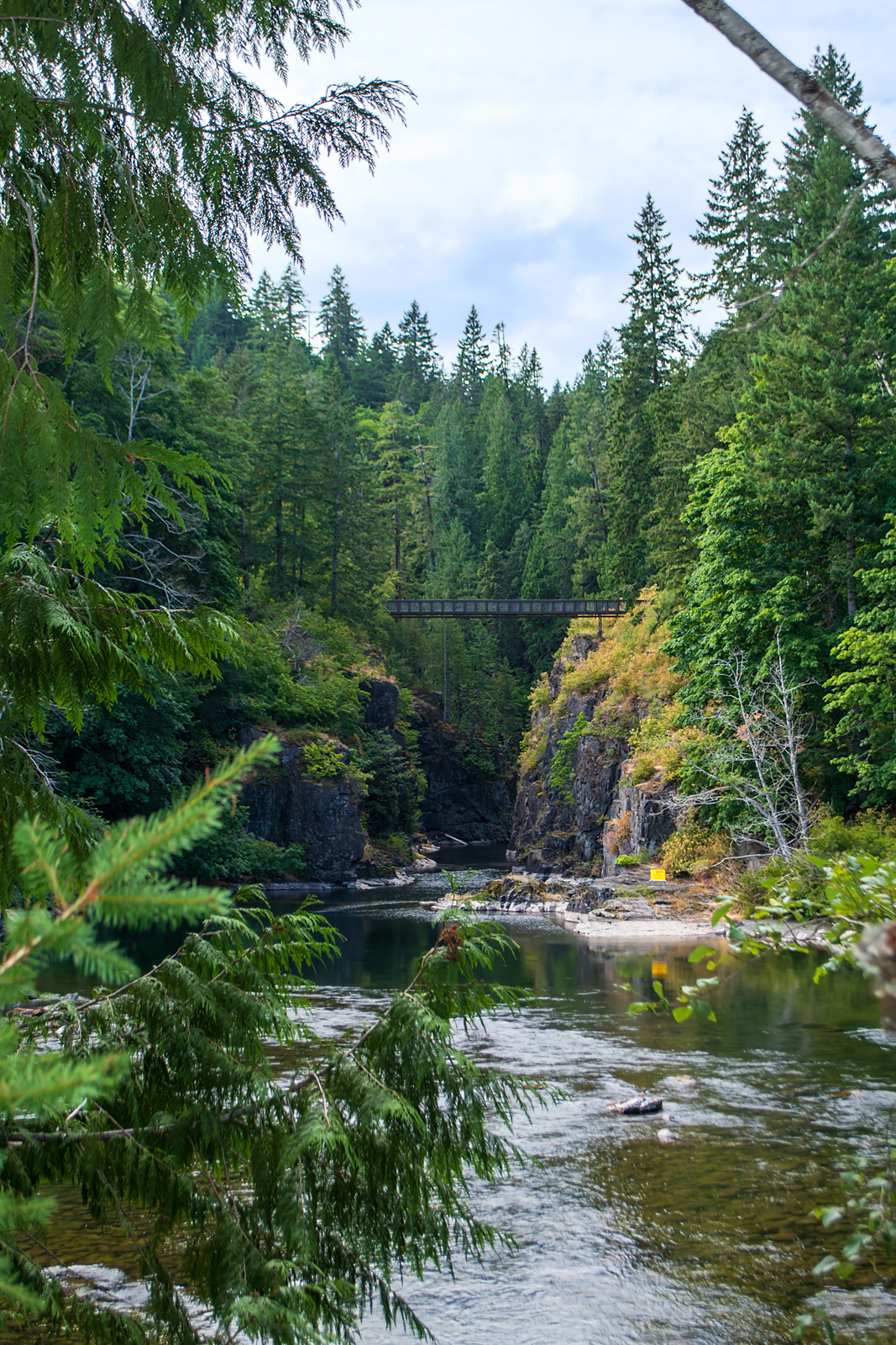
Looking at trail maps around the Campbell River, I saw a photo of a pedestrian (one at a time) bridge high over the river, a bridge not marked on most of the trail maps, but there was this one photo. I had to go see it.

The bridge from the first vantage point.

The trail starts at the 
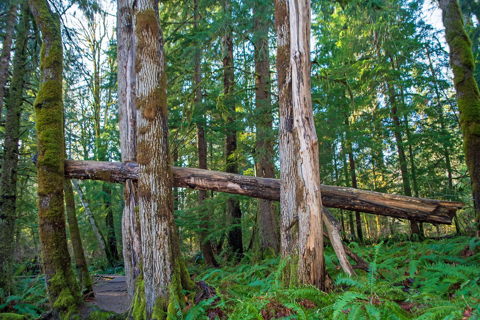
John Hart generating station, and at first goes through walled-off alleys between the river and the station; there's an open spot with benches, photos of the underground workings, and totem poles, and then more alleys, with a hidden entrance. Once around the corner, though, you come out to a view of the river. And a staircase, a couple of hundred steps going up the hillside, flanked by blackberry bushes. Then a trail, still climbing. A short drop, a curve, and the bridge over a narrow canyon at the bottom. Then the trail goes on, climbing again. I stopped at the bridge.

The view downstream. The white buildings behind the trees on the right are the generating station..

And the view looking upstream from the centre of the bridge.

The view from the far end of the bridge.

I went off the path to the top of the rocks, to get a higher view. And from there, I could see around the bend in the river.

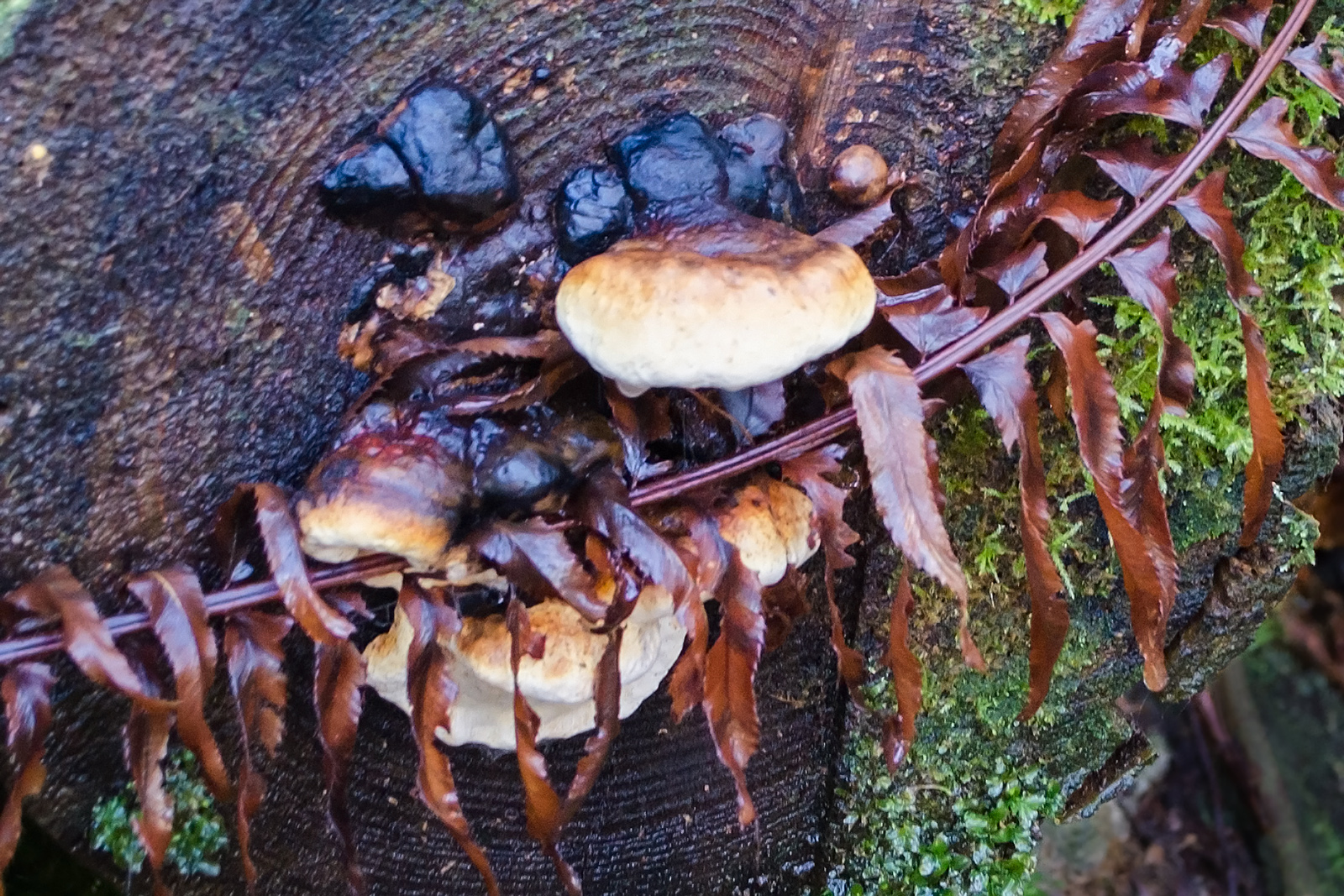
And what's that down there in the water?

Some sort of spinning device, anchored in mid-stream.

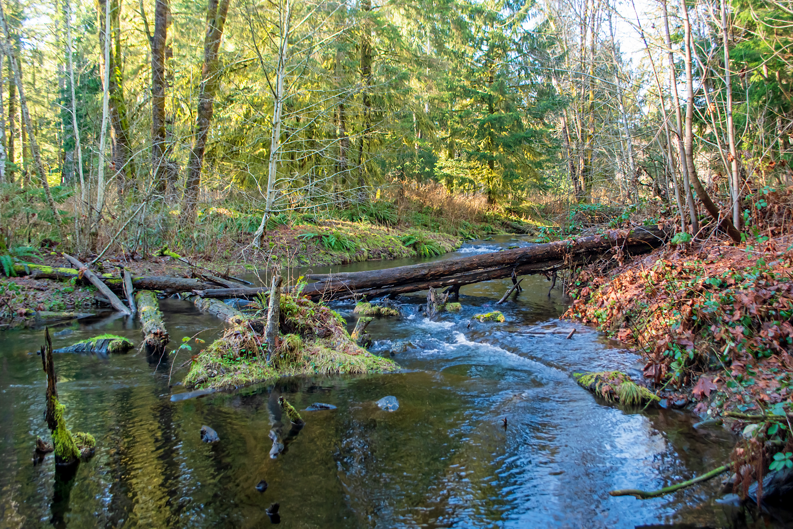
The river is narrow and shallow here, since most of the water is piped through the station's three generators. But the water level is lower, too; you can see the white, scoured rock where the water reaches in wetter seasons.

But what is that spinning thing?

~~~~~~~~~~~~~~~~~~~~~

Viendo mapas de senderos alrededor del rio Campbell, encontré una foto de un puente que no había visto; un puente para peatones, un puente angosto, donde hay que pasar en fila. Pues tenía que ir a verlo.

Primera foto: el puente desde el primer lugar donde salió a la vista.

El camino empieza en la planta hidroeléctrica John Hart, y al principio pasa entre paredes que esconden tanto la planta como el rio. Luego hay un area con asientos, fotos informativos sobre la planta subterránea, y postes tótem; después sigue el camino entre paredes por un poco, y por fin salimos a campo abierto. Y a una escalera que sube el cerro; unos doscientos escalones. Luego un sendero sigue subiendo, una curva, y allí abajo está el puente. El camino sigue, subiendo aun; yo allí me detuve.

Segunda foto: La vista desde el puente, mirando rio abajo. Los edificios que se ven tras los árboles son los de la planta generadora.

Tercera foto: la vista desde el centro del puente, mirando rio arriba.

Cuarta: desde el final del puente.

Me salí del camino para subirme a las rocas para una mejor vista del rio. Y desde allí, pude ver más allá de la curva en el rio.

Quinta y sexta fotos: ¿Y qué es esa cosa que gira y gira allí abajo?

El rio es angosto y lleva poca agua aquí; la mayor parte del agua se ha desviado hacia las tres generadores de la planta subterránea. Pero en esta temporada, también el nivel del agua ha bajado; se ve la roca blanca que en otras temporadas estaría cubierta de agua.

¿Pero, qué sería esa cosa en el agua?

Tuesday, February 12, 2019

On the wet forest floor

A few leftover photos from Canyonview Trail.

Layered fallen leaves on an upside-down fern frond. Fern, Bigleaf Maple, Red alder, Bigleaf Maple (3) and Red alder on top. As found. On a foundation of decomposed leaves and ferns plastered on a stump.

Licorice fern on a downed branch. I lifted the branch and found that it has entirely decomposed; all that is left is the moss and the fern rhizomes, still holding the shape of the branch. 

Oregon beaked moss on a stump.

It's snowing again. Third day in a row. Winter is finally here!

Monday, February 04, 2019

Mostly tiny umbrellas

These are the rest of the "ordinary" mushrooms from the Canyonview Trail. (Note: "ordinary" does not mean "boring" nor does it detract from their beauty. It's just that they're there, everywhere, behind every log, in every patch of decomposing maple leaves, pushing through every moss blanket.)

Probably Mycena sp. With two species of moss, Beaked Oregon, and possibly
Electrified Cat's tail. And more of that powdery stuff.

On the ground with moss. I think the one at upper left is the Coastal Leafy moss.

Another moss, another umbrella. Palm tree moss, maybe?

A greyer variety. On moss and Bigleaf maple leaves.

A larger mushroom, on a mossy log.

On the end of a log, an outbreak of Red-belted polypores. Are the glossy black lumps older reds, or are they a different species altogether? I don't know. The woods are full of mystery!

Sunday, February 03, 2019

More white stuff

I've paged through my mushroom and slime mold books over and over, and can't identify these.

On the underside of a log

This was the largest of a series of patches of a white and cream growth, soft and moist, with pink spots in the thicker areas. Fungus? Slime mold? I don't know.

A closer look. 

And then there's this:

White and green powders

Many of the stumps and trees along the Canyonview Trail are covered with a fine white or green powder, spreading itself sometimes over the whole stump. In the photo above, it's even growing on the spider webs. Another one I can't identify.

On a small, broken twig lying on the ground, I found these white mushrooms growing:

Top view. Fanning out from a side stalk. The moss shows the size.

And the view from underneath. The curve at the left is my thumb.


Thursday, January 31, 2019

Hideaways

Miniature white mushrooms hiding in cracks in tree bark:

Pure white balls, pinhead to marble size.

These are a bit larger, and stalked. Growing under roots on a nurse stump.

Zooming in on others on the same roots. They burst through from the inner "meat" of the roots; note the broken end, where no bark impedes their growth.

These grow in clusters from bottom to top of a deep crack in the bark.

And where the bark is long gone, these side-stalked tan mushrooms force their way out.

I've tried and failed to identify these beauties.

Wednesday, January 30, 2019

What are these?

Upside-down mushrooms? With the hyphae out in the open?

Or something else? A slime mold, maybe?

They are tiny: compare to the size of the moss at the end of the stick. They were on broken twigs on the ground under the shelter of old logs.

 More. Most were like this; radiating spikes bursting out of the twigs.


Monday, January 28, 2019

Cat's tongues, Electrified tails, and Oregon hat decor.

It's a while since I've seen cat's tongue fungus, and never more than one at a time. This week, on the Canyonview trail, there were many, mostly on the back side of mossy logs.


Cat's tongue, Pseudohydnum gelatinosum. AKA quivering spine fungus, white tooth jelly, etc. The moss, I think, is Electrified Cat's tail. To go with the tongues.


On another log. I like the delicate scalloped edges. The stalk often extends to the side, towards the woody base.

Red-belted polypore, Fromitopsis pinicola, wearing a hat decorated with Oregon beaked moss.

Orange jelly, on a very wet log. It hadn't been raining, but this forest is very damp, and takes days of sunshine to dry out. Note the tiny, dark blue buttons; probably early lichen settlers.

Powered By Blogger