Showing posts with label wetland restoration. Show all posts

Thursday, March 11, 2021

The estuary and its birds

The Myrt Thompson trail travels down the centre of the Campbell River estuary, following a narrow spit and a series of islets connected by 5 bridges, ending where the river comes together and widens into a bay. There's still one island and the enclosing Tyee Spit before the river reaches the ocean. The islands are mostly mud flats, covered with long grasses, brown most of the year.

Birds love these flats and the quiet backwaters as the river wanders around the islands.

Mud flat, with great blue heron and sleepy mallards.

Twig and branch fence, common goldeneyes.

The Wei Wai Kum band, as part of their wetlands restoration project, is installing these alder branch fences (weirs) just offshore around the mud flats, to encourage the growth of native sedges and reduce erosion.
The barriers keep geese and inquisitive kayakers out of sensitive ecosystems. ... Introducing native plants was another part of the restoration project. Which explains the lush sedge grass (also known as carex grass), along the banks. Sedge grass not only prevents the river banks from receding but is also an excellent source of protein for bears, geese and ungulates in the area.
“The grass is especially important for bears to get their digestive systems rolling in the spring when they wake up from their hibernation,” ... (VancouverIslandFreeDaily)

Drawing Vs in shallow, grassy water.

The north shore is still heavily industrial. Here, a line of goldeneyes crosses the centre of the river.

A common merganser heading downstream, half hidden by ripple patterns.

~~~~~~~~~~~~
El sendero "Myrt Thompson" baja por el centro del estuario del rio Campbell, aprovechando una lengua de tierra angosta y luego una serie de islitas unidas por cinco puentecitos, y terminando donde los varios canales del rio se juntan para formar una bahía. Falta todavía una isla más y luego la lengua de tierra Tyee, antes de que el rio salga al estrecho del mar. Las islas son, por la mayor parte, pantanos cubiertos de pastos y juncias, de color café por gran parte del año.

Y siempre hay pájaros, en el pasto, bajando con la corriente del agua, o descansando en las aguas tranquilas entre islas.

Primera foto: un pantano, con una garza azul pescando, y varios patos mallard dormilones.

Segunda foto: porrones osculados y una cerca de ramas.

La tribu Wei Wai Kum, como parte de su proyecto de restauración de los humedales, está instalando estas cercas hechas de ramas de aliso alrededor de las islas y pantanos para estimular el crecimiento de juncias nativas y para reducir la erosión.

"Estas barreras mantienen alejados los gansos y kayakistas curiosos de los ecosistemas frágiles. ... Introducir plantas nativas tambien fue parte del proyecto de restauración. Esto explica las juncias (Carex) exuberantes a las márgenes del río. Las juncias no solo protege las márgenes contra la erosión, sino que tambien es una fuente excelente de proteína para los osos, los gansos, y los ungulados (venados, por ejemplo) del rumbo.—Esta hierba es especialmente importante para los osos cuando salen de la hibernación en la primavera, para poner su sistema digestiva en marcha." (Del periódico VancouverIslandFreeDaily)

Tercera foto: patos marcando "V's en agua de poca profundidad.

Cuarta foto: Hacia el norte del río, el terreno está ocupada por industrias pesadas. Aquí una bandada de porrones cruza el centro del río.

Quinta foto: Una serreta grande, bajando por el río, casi escondida entre las ondulaciones del agua.
Friday, January 17, 2020

Where the ice was

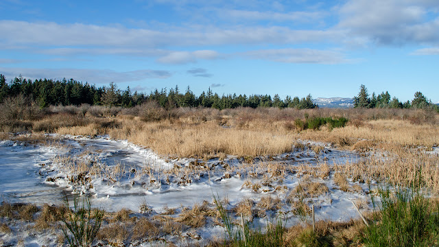
I took photos of the wetlands under ice just in time. Now they're under a foot of snow.

View over the southeast end of the marsh, looking northeast. The hills beyond are on the mainland.

There is a sign beside the road; I stopped to read it.

Description of the restoration program.

The sign reads: Environmentally Sensitive Fish Habitat. Discovery Harbour Shopping Centre Ltd, developed and managed by the Campbell River Indian Band and Northwest Properties in conjunction with Federal Fisheries and Oceans and the Canadian Wildlife Service conducted a low marsh restoration and planting program in the Campbell River Estuary within Lot 136 and Spit Road in 1997 and 1999. As part of the estuary restoration plan, relocation of Old Spit Road occurred and natural estuary was re-established. Designed by TERA Planning Ltd, the planting was completed by members of the Campbell River Indian Band.

(This whole area had been used for logging operations, heavy equipment and other industrial uses for most of the last century. Now, it is being restored, piece by piece.)

Continuing with the text of the sign: To assist the natural recolonization of the estuary area, salvaged vegetative material was stockpiled for use. Approximately 800 sq m of plant material, including Lyngbye's and other sedges, spikerush, hairgrass and other low marsh species were removed and stored in a donor site. The existing slough was not touched.

(Me again. I'd never heard of these wetlands species. I looked them up. Lyngbye's sedge is "often the most dominant species in tidal marshes ..." [Plants of Coastal BC] "This is a pioneer species, one of the first plants to colonize the mud of tidal flats in its range. [Wikipedia]

Spikerush is not a rush, but a creeping wetland sedge. Hairgrass would be the tufted hairgrass, Deschampsia cespitosa; it is a native perennial grass about a metre tall. Some of the photos I took of the ice look like the base is this grass.)

Back to the sign: The eastern half of the program was conducted in the spring of 1997 and the culverts at Old Spit Road were opened at that time. This included the removal of shrub vegetation and soil, followed by the establishment of a network of channels planted with approximately 400 sq m of the stockpiled vegetation (or 20,000 15 cm x 15 cm cylinders of marsh material.)

A lot of work! The shrub vegetation removed would have included the invasive Himalayan blackberry: there is still a heavy infestation in the area between this wetland and the river bank.

Photos from the sign

The western half and the area under the Old Spit Road were replanted in early 1999. Construction was similar to that done for the eastern half. This phase saw the decommissioning of Old Spit Road itself. This project has created approximately 2 ha of low marsh. The new marsh is now an important contributor of fish nutrients and provides rearing habitat for your salmon.

I went looking for this old road last year. I found the end of it, but it petered out in a few metres. It's bird, bug, and fish habitat now. And maybe chocolate lily habitat, but I'll have to forgo looking for them.

Under the roof of the above sign. Juvenile salmon live here!!

Google map of the area, with my labels.


Powered By Blogger